|
search place name
|
||
Pontellas (Galicia, Spain)Pontellas is a town in the Galicia region of Spain. An overview map of the region around Pontellas is displayed below.
regional and 3d topo map of Pontellas, Spain ::

Pontellas airports ::
The nearest airport is VGO - Vigo, located 11.0 km north of Pontellas.
Other airports nearby include SCQ - Santiago (86.6 km north), OPO - Porto (98.4 km south), VRL - Vila Real (122.0 km south east), LCG - La Coruna A Coruna (131.5 km north), Nearby towns ::
Torneiros (1.9km north) //
Chenlo (2.3km south west) //
Mosende (2.3km south west) //
Ribadelouro (3.7km south) //
Atios (2.7km east) //
Pereiras (3.7km north) //
Porriño (4.0km north) //
Budiño (4.6km south east) //
Cela (4.6km north west) //
Petelos (5.6km north) //
Sanguiñeda (5.6km north) //
Pazos de Reyes (5.7km south) //
Budiño (5.5km south east) //
Soutelo (6.2km south east) //
Cans (5.5km north east) //
Rebordanes (7.4km south) //
Picoña (5.8km east) //
Guillarey (7.5km south) //
Salceda (5.8km east) //
Torroso (7.5km north) //
Tameiga (7.5km north) //
Parderrubias (6.6km south east) //
Páramos (7.9km south) //
Entienza (7.8km south east) //
Baldranes (8.5km south east) //
Guillarey (8.5km south east) //
Bembribe (8.5km north west) //
Beade (9.2km north west) //
Castrelos (9.2km north west) //
[all distances 'as the bird flies' and approximate] 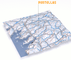 Places with similar names to Pontellas, Spain ::
// Ponte a Elsa (IT)
// Puntalazzo (IT)
// Pandėlys (LT)
// Pantelići (BA)
// Pantelići (BA)
// Pantelići (BA)
// Pantelići (BA)
// Pendueles (ES)
// Pintueles (ES)
// Pontellas (ES)
Disclaimer :: Information on this page comes without warranty of any kind |
||
|
Where is Pontellas? Elevation and coordinates ::
Latitude (lat): 42°8'0"N Longitude (lon): 8°38'0"W
Elevation (approx.): 21m (map arrows pan, magnifying glasses zoom) |
||
|
Visiting Pontellas? Hotel/Accommodation ::
Book a hotel in Pontellas Travel Guide ::
Buy a travel guide for Spain rental cars ::
car rental offers GPS waypoint ::
download a GPX waypoint (PoI) of Pontellas for your GPS receiver
|
||