|
search place name
|
||
San Juan de la Rambla (Canarias, Spain)San Juan de la Rambla is a town in the Canarias region of Spain. An overview map of the region around San Juan de la Rambla is displayed below.
regional and 3d topo map of San Juan de la Rambla, Spain ::

San Juan de la Rambla airports ::
The nearest airport is TFN - Tenerife Norte, located 30.6 km east of San Juan de la Rambla.
Other airports nearby include TFS - Tenerife Sur (38.0 km south), SPC - Santa Cruz De La Palma La Palma (113.1 km west), LPA - Gran Canaria (132.3 km east), VDE - Hierro (138.4 km south west), Nearby towns ::
Portalina (0.0km north) //
La Vera (0.0km north) //
Las Rosas (1.9km south) //
Las Aguas (1.9km north) //
La Guancha (2.5km south west) //
La Rambla (2.5km north east) //
Santa Catalina (3.3km west) //
Icod el Alto (3.8km south east) //
Guancha de Abajo (3.8km south west) //
San Vicente (6.5km east) //
Realejo Bajo (6.5km east) //
Tigaiga (6.8km east) //
Realejo Alto (6.8km east) //
Icod de los Vinos (7.5km south west) //
El Amparo (7.5km south west) //
[all distances 'as the bird flies' and approximate] 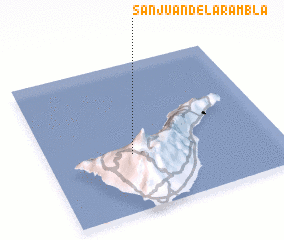 Places with similar names to San Juan de la Rambla, Spain :: Disclaimer :: Information on this page comes without warranty of any kind |
||
|
Where is San Juan de la Rambla? Elevation and coordinates ::
Latitude (lat): 28°23'0"N Longitude (lon): 16°38'0"W
Elevation (approx.): 467m (map arrows pan, magnifying glasses zoom) |
||
|
Visiting San Juan de la Rambla? Hotel/Accommodation ::
Book a hotel in San Juan de la Rambla Travel Guide ::
Buy a travel guide for Spain rental cars ::
car rental offers GPS waypoint ::
download a GPX waypoint (PoI) of San Juan de la Rambla for your GPS receiver
|
||