|
search place name
|
||
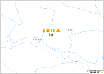
Bontrug (South Africa)Bontrug is a town in South Africa. An overview map of the region around Bontrug is displayed below.
regional and 3d topo map of Bontrug, South Africa ::
Bontrug airports ::
The nearest airport is PLZ - Port Elizabeth Intl, located 66.2 km south of Bontrug.
Other airports nearby include VIY - Bisho Bhisho (176.2 km east), UTW - Queenstown (209.7 km north east), Nearby towns ::
 Places with similar names to Bontrug, South Africa ::
// Bandurica (BA)
// Bentarique (ES)
// Bondarka (RU)
// Bandargāh (IR)
// Bandargāh (IR)
// Bandargāh (IR)
// Bantirago (GH)
// Bint Ruqayyah (SD)
// Bandirak (SY)
// Ban Tariak (LA)
Disclaimer :: Information on this page comes without warranty of any kind |
||
|
Where is Bontrug? Elevation and coordinates ::
Latitude (lat): 33°23'52"S Longitude (lon): 25°29'13"E
Elevation (approx.): 173m (map arrows pan, magnifying glasses zoom) |
||
|
Visiting Bontrug? Hotel/Accommodation ::
Book a hotel in Bontrug Travel Guide ::
rental cars ::
car rental offers GPS waypoint ::
download a GPX waypoint (PoI) of Bontrug for your GPS receiver
|
||