|
search place name
|
||
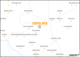
Dorsland (South Africa)Dorsland is a town in South Africa. An overview map of the region around Dorsland is displayed below.
regional and 3d topo map of Dorsland, South Africa ::
Dorsland airports ::
The nearest airport is PTG - Pietersburg, located 65.4 km east of Dorsland.
Other airports nearby include LTA - Tzaneen (150.7 km east), PRY - Pretoria Wonderboom (211.4 km south), PKW - Selebi-phikwe Selebi Phikwe (222.7 km north west), NTY - Pilanesberg Intl (237.6 km south west), Nearby towns ::
Ga-Mabusela (2.5km south west) //
Malokong (2.5km south west) //
Pudiyakgopa (5.1km west) //
Limburg (6.3km north east) //
Harmonie (6.3km north east) //
Ga-Rammu (8.2km south west) //
Hendrik Bakenberg Masibislokasie (7.7km south west) //
Ga-Makoena (9.0km north west) //
Suid-Holland (8.8km south east) //
[all distances 'as the bird flies' and approximate] 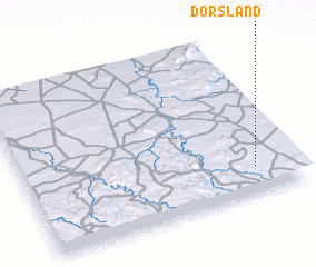 Places with similar names to Dorsland, South Africa ::
// Torsland (NO)
// Deer Island (US)
// Deer Island (US)
// Torslanda (SE)
// Dørslund (DK)
// Tirslund (DK)
// Torslunde (DK)
// Torslunde (DK)
// Torslunde (DK)
// Torslunda (SE)
Disclaimer :: Information on this page comes without warranty of any kind |
||
|
Where is Dorsland? Elevation and coordinates ::
Latitude (lat): 23°50'0"S Longitude (lon): 28°51'0"E
Elevation (approx.): 1100m (map arrows pan, magnifying glasses zoom) |
||
|
Visiting Dorsland? Hotel/Accommodation ::
Book a hotel in Dorsland Travel Guide ::
rental cars ::
car rental offers GPS waypoint ::
download a GPX waypoint (PoI) of Dorsland for your GPS receiver
|
||