|
search place name
|
||
Maokantsi (South Africa)Maokantsi is a town in South Africa. An overview map of the region around Maokantsi is displayed below.
regional and 3d topo map of Maokantsi, South Africa ::

Maokantsi airports ::
The nearest airport is VRU - Vryburg, located 91.2 km east of Maokantsi.
Other airports nearby include SIS - Sishen (102.3 km south west), KIM - Kimberley (212.2 km south east), MBO - Mmabatho Mafikeng (223.8 km north east), Nearby towns ::
Dithakong (3.3km east) //
Maputsane (3.7km south) //
Bothithong (4.1km north east) //
Ga-Honyane (4.1km south east) //
Mogononong (5.0km north west) //
Ga-Popo (5.8km north) //
Maputsane (5.3km east) //
Ga-Makgatle (6.5km north east) //
Djdibaneng (6.5km south east) //
Mamontsane (6.5km south east) //
Vlakpan (6.2km south west) //
Magobeng (6.5km north west) //
Gatong (6.6km east) //
Lotlhakane (7.4km south) //
Matemeng (7.6km north) //
Keang (7.6km north) //
Matshaneng (6.9km west) //
Ga-Huhuwe (7.6km south east) //
Lobutsane (8.6km south east) //
Kubuga (9.9km north west) //
[all distances 'as the bird flies' and approximate] 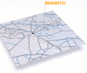 Places with similar names to Maokantsi, South Africa ::
// McNatts (US)
// Mokhnetsy (RU)
// Moukondza (CG)
// Moukondzi (CG)
// Moukondzi (CG)
// Makondzi (GA)
// Mikouandza II (GA)
// Mogondzo (GA)
// Mougandza (GA)
// Moukoundza (GA)
Disclaimer :: Information on this page comes without warranty of any kind |
||
|
Where is Maokantsi? Elevation and coordinates ::
Latitude (lat): 27°5'0"S Longitude (lon): 23°49'0"E
Elevation (approx.): 1281m (map arrows pan, magnifying glasses zoom) |
||
|
Visiting Maokantsi? Hotel/Accommodation ::
Book a hotel in Maokantsi Travel Guide ::
rental cars ::
car rental offers GPS waypoint ::
download a GPX waypoint (PoI) of Maokantsi for your GPS receiver
|
||