|
search place name
|
||
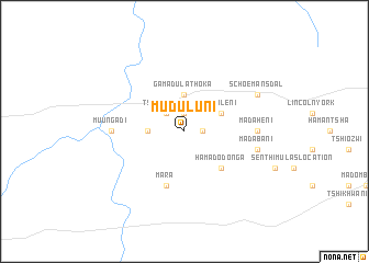
Muduluni (South Africa)Muduluni is a town in South Africa. An overview map of the region around Muduluni is displayed below.
regional and 3d topo map of Muduluni, South Africa ::
Muduluni airports ::
The nearest airport is PTG - Pietersburg, located 96.7 km south of Muduluni.
Other airports nearby include LTA - Tzaneen (108.9 km south east), PHW - Phalaborwa (181.5 km south east), HDS - Hoedspruit Afb (202.8 km south east), PKW - Selebi-phikwe Selebi Phikwe (218.1 km north west), Nearby towns ::
Moebani (1.9km north) //
Kutamaʼs Location (1.7km east) //
Tshikwarani (2.5km north west) //
Ha-Manavhela (3.4km west) //
Ga-Madulathoka (3.7km north) //
Muraleni (3.9km north east) //
Ha-Madodonga (5.0km south east) //
Mara (5.8km south) //
Muungadi (6.8km west) //
Madaheni (6.8km east) //
Madabani (7.1km east) //
Schoemansdal (7.8km north east) //
[all distances 'as the bird flies' and approximate]  Places with similar names to Muduluni, South Africa ::
// Motla-in (MM)
// Mitylene (US)
// Matélon (CH)
// Madulein (CH)
// Madeline (US)
// Medelon (DE)
// Mittellohne (DE)
// Madalline (US)
// Media Luna (PA)
// Medelana (IT)
Disclaimer :: Information on this page comes without warranty of any kind |
||
|
Where is Muduluni? Elevation and coordinates ::
Latitude (lat): 23°4'0"S Longitude (lon): 29°39'0"E
Elevation (approx.): 864m (map arrows pan, magnifying glasses zoom) |
||
|
Visiting Muduluni? Hotel/Accommodation ::
Book a hotel in Muduluni Travel Guide ::
rental cars ::
car rental offers GPS waypoint ::
download a GPX waypoint (PoI) of Muduluni for your GPS receiver
|
||