|
search place name
|
||
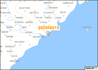
Qora Mouth (South Africa)Qora Mouth is a town in South Africa. An overview map of the region around Qora Mouth is displayed below.
regional and 3d topo map of Qora Mouth, South Africa ::
Qora Mouth airports ::
The nearest airport is UTT - Umtata Mthatha, located 100.0 km north of Qora Mouth.
Other airports nearby include ELS - East London (103.3 km south west), VIY - Bisho Bhisho (140.7 km west), UTW - Queenstown (179.7 km west), MGH - Margate (236.6 km north east), Nearby towns ::
Nkawukazi (2.4km north west) //
KuLojingqi (3.7km north) //
Zitenji (4.0km north west) //
Mazeppa Bay (3.6km south west) //
Ngadla (5.6km north) //
Ntilini (6.4km north west) //
Lalini (6.4km north east) //
Gciala (6.3km west) //
Ngadla (7.4km north) //
Ntlanzini (7.4km north) //
KuLofumbata (7.6km north) //
Maxambeni (7.3km south west) //
KwaHadi (7.3km north west) //
KuNkazana (8.4km north west) //
Qazini (8.8km north east) //
Ngcizele (8.8km north west) //
[all distances 'as the bird flies' and approximate] 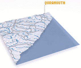 Places with similar names to Qora Mouth, South Africa ::
Disclaimer :: Information on this page comes without warranty of any kind |
||
|
Where is Qora Mouth? Elevation and coordinates ::
Latitude (lat): 32°27'0"S Longitude (lon): 28°41'0"E
Elevation (approx.): -32768m (map arrows pan, magnifying glasses zoom) |
||
|
Visiting Qora Mouth? Hotel/Accommodation ::
Book a hotel in Qora Mouth Travel Guide ::
rental cars ::
car rental offers GPS waypoint ::
download a GPX waypoint (PoI) of Qora Mouth for your GPS receiver
|
||