|
search place name
|
||
Agrukhino (Tverskaya Oblast', Russia)Agrukhino is a town in the Tverskaya Oblast' region of Russia. An overview map of the region around Agrukhino is displayed below.
regional and 3d topo map of Agrukhino, Russia ::

Agrukhino airports ::
The nearest airport is KLD - Tver Migalovo, located 117.2 km south east of Agrukhino.
Nearby towns ::
Volkovo (1.4km south) //
Bobrova (1.7km north east) //
Rog (2.0km north west) //
Dyatlovo (2.7km south east) //
Mal'tseva (3.7km north east) //
Maloye Gudobino (3.5km south west) //
Pot'yanikha (4.0km north west) //
Dudikha (3.4km east) //
Rechka (5.0km north west) //
Staroye (3.9km west) //
Voloshno (4.7km north east) //
Yunyakhino (4.3km east) //
Zashishëv'ye (6.3km north west) //
Dershino (7.1km south east) //
Vasilëvo (4.8km west) //
Dorukha (6.1km south east) //
Malyye Malosheviny (7.6km north west) //
[all distances 'as the bird flies' and approximate] 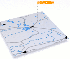 Places with similar names to Agrukhino, Russia :: Disclaimer :: Information on this page comes without warranty of any kind |
||
|
Where is Agrukhino? Elevation and coordinates ::
Latitude (lat): 57°43'24"N Longitude (lon): 34°44'44"E
Elevation (approx.): 163m (map arrows pan, magnifying glasses zoom) |
||
|
Visiting Agrukhino? Hotel/Accommodation ::
Book a hotel in Agrukhino Travel Guide ::
Buy a travel guide for Russia rental cars ::
car rental offers GPS waypoint ::
download a GPX waypoint (PoI) of Agrukhino for your GPS receiver
|
||