|
search place name
|
||
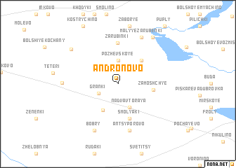
Andronovo (Smolenskaya Oblast', Russia)Andronovo is a town in the Smolenskaya Oblast' region of Russia. An overview map of the region around Andronovo is displayed below.
regional and 3d topo map of Andronovo, Russia ::
Andronovo airports ::
The nearest airport is VTB - Vitebsk, located 77.1 km north west of Andronovo.
Nearby towns ::
Granki (2.3km south west) //
Pozhevskoye (3.7km north) //
Nadva Vtoraya (3.9km south) //
Nadva (3.9km south) //
Korobanovo (4.4km south) //
Tyuli (4.3km north east) //
Zamoshch'ye (3.4km east) //
Smolyaki (5.7km south) //
Zarubinki (6.5km north) //
Antsyporovo (7.5km south) //
Malyye Zarubenki (7.7km north) //
Bobry (7.7km south) //
Golynki (5.1km west) //
Golyashi (8.1km north east) //
Krasnaya Dubrova (7.0km north west) //
[all distances 'as the bird flies' and approximate] 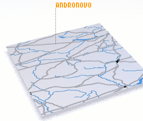 Places with similar names to Andronovo, Russia ::
// Andrianiv (UA)
// Andreanovo (RU)
// Andrianov (RU)
// Andrianovo (RU)
// Andrianovo (RU)
// Andrianovo (RU)
// Andrianovo (RU)
// Andrianovo (RU)
// Andronova (RU)
// Andronovo (RU)
Disclaimer :: Information on this page comes without warranty of any kind |
||
|
Where is Andronovo? Elevation and coordinates ::
Latitude (lat): 54°52'0"N Longitude (lon): 31°28'0"E
Elevation (approx.): 190m (map arrows pan, magnifying glasses zoom) |
||
|
Visiting Andronovo? Hotel/Accommodation ::
Book a hotel in Andronovo Travel Guide ::
Buy a travel guide for Russia rental cars ::
car rental offers GPS waypoint ::
download a GPX waypoint (PoI) of Andronovo for your GPS receiver
|
||