|
search place name
|
||
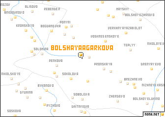
Bol'shaya Agarkova (Kurskaya Oblast', Russia)Bol'shaya Agarkova is a town in the Kurskaya Oblast' region of Russia. An overview map of the region around Bol'shaya Agarkova is displayed below.
regional and 3d topo map of Bol'shaya Agarkova, Russia ::
Bol'shaya Agarkova airports ::
The nearest airport is BZK - Bryansk, located 187.0 km north west of Bol'shaya Agarkova.
Nearby towns ::
Khrenovets (0.9km east) //
Verkhneye Bartenevo (3.3km north east) //
Nikovets (4.9km north) //
Sokolova (4.9km south) //
Balychevo (5.3km south) //
Pronskaya (3.9km south east) //
Khardinovo (3.8km north east) //
Pen'kova (4.0km south west) //
Voskresenskoye (5.1km north east) //
Ivanovskiy (6.1km north west) //
Razin'kovo (5.0km south east) //
Alyab'yeva (5.4km south west) //
Filippova (5.1km south west) //
Kolychevo (7.6km north) //
Ponyri (7.6km north) //
Bogdanovka (7.7km north west) //
Tolmachëvo (7.5km south east) //
Bykanovo (8.9km south west) //
[all distances 'as the bird flies' and approximate] 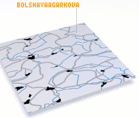 Places with similar names to Bol'shaya Agarkova, Russia ::
// Bol'shoye Korkovo (RU)
Disclaimer :: Information on this page comes without warranty of any kind |
||
|
Where is Bol'shaya Agarkova? Elevation and coordinates ::
Latitude (lat): 51°52'51"N Longitude (lon): 35°51'13"E
Elevation (approx.): 215m (map arrows pan, magnifying glasses zoom) |
||
|
Visiting Bol'shaya Agarkova? Hotel/Accommodation ::
Book a hotel in Bol'shaya Agarkova Travel Guide ::
Buy a travel guide for Russia rental cars ::
car rental offers GPS waypoint ::
download a GPX waypoint (PoI) of Bol'shaya Agarkova for your GPS receiver
|
||