|
search place name
|
||
Grankino (Kaluzhskaya Oblast', Russia)Grankino is a town in the Kaluzhskaya Oblast' region of Russia. An overview map of the region around Grankino is displayed below.
regional and 3d topo map of Grankino, Russia ::

Grankino airports ::
The nearest airport is BZK - Bryansk, located 149.5 km south of Grankino.
Nearby towns ::
Zhdanovo (1.9km south) //
Dvorishche (2.7km north) //
Nosonovo (4.0km north) //
Bol'shoye Tesnoye (3.8km north west) //
Pavlinovo (5.5km south) //
Rechitsy (6.4km north) //
Gnezdilovo (3.8km east) //
Terent'yevo (6.0km north) //
Klyushki (5.2km south west) //
Shimeni (7.8km north) //
Risavy (7.4km north) //
Berëzovo (8.2km south) //
Log (8.4km south) //
Gorki (7.9km north) //
Kamenka (6.6km north east) //
Zamosh'ye (7.3km north west) //
Uspekh (8.6km south east) //
Radki (8.8km south east) //
Massoly (9.7km north west) //
[all distances 'as the bird flies' and approximate] 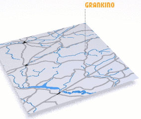 Places with similar names to Grankino, Russia ::
// Carangan (PH)
// Carangan (PH)
// Carangan (PH)
// Caranguian (PH)
// Carañugan (PH)
// Carinogan (PH)
// Cauriñgan (PH)
// Carnigan (US)
// Crîngu Nou (RO)
// Grankina (RU)
Disclaimer :: Information on this page comes without warranty of any kind |
||
|
Where is Grankino? Elevation and coordinates ::
Latitude (lat): 54°32'0"N Longitude (lon): 33°45'0"E
Elevation (approx.): 205m (map arrows pan, magnifying glasses zoom) |
||
|
Visiting Grankino? Hotel/Accommodation ::
Book a hotel in Grankino Travel Guide ::
Buy a travel guide for Russia rental cars ::
car rental offers GPS waypoint ::
download a GPX waypoint (PoI) of Grankino for your GPS receiver
|
||