|
search place name
|
||
Kartashëvo (Tul'skaya Oblast', Russia)Kartashëvo is a town in the Tul'skaya Oblast' region of Russia. An overview map of the region around Kartashëvo is displayed below.
regional and 3d topo map of Kartashëvo, Russia ::

Kartashëvo airports ::
The nearest airport is VKO - Moscow Vnukovo, located 115.1 km north of Kartashëvo.
Other airports nearby include SVO - Moscow Sheremetyevo (158.1 km north), Nearby towns ::
Botnya (2.2km south) //
Sotino (3.0km north) //
Myasoyedovo (3.0km north west) //
Sosnovka (2.4km north west) //
Solomasovo (3.1km east) //
Bunyrëvo (3.4km west) //
Aydarovo (5.7km north west) //
Lytkino (5.5km north east) //
Kokhanovo (5.7km north west) //
Levshino (5.2km north west) //
Kaznacheyevo (5.8km south east) //
Yegnyshëvka (8.4km north) //
Kolomino (5.1km west) //
Khatmanovo (5.1km east) //
Sharapovo (6.4km north west) //
Sviridovo (8.3km south) //
Bol'shoye Shelepino (8.9km south) //
Uspenskiy Posëlok (9.0km north) //
Khripkovskiye Vyselki (9.1km north east) //
Voznesen'ye (8.0km north west) //
Bukhtorna (9.3km south west) //
[all distances 'as the bird flies' and approximate] 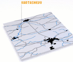 Places with similar names to Kartashëvo, Russia ::
// Kardashëv (UA)
// Khretasheva (UA)
// Kordyshëv (UA)
// Gordychëvo (RU)
// Kartashëva (RU)
// Kartashëva (RU)
// Kartashëvo (RU)
// Kartashëvo (RU)
// Kartashëvo (RU)
// Kartashëvo (RU)
Disclaimer :: Information on this page comes without warranty of any kind |
||
|
Where is Kartashëvo? Elevation and coordinates ::
Latitude (lat): 54°33'28"N Longitude (lon): 37°12'0"E
Elevation (approx.): 139m (map arrows pan, magnifying glasses zoom) |
||
|
Visiting Kartashëvo? Hotel/Accommodation ::
Book a hotel in Kartashëvo Travel Guide ::
Buy a travel guide for Russia rental cars ::
car rental offers GPS waypoint ::
download a GPX waypoint (PoI) of Kartashëvo for your GPS receiver
|
||