|
search place name
|
||
Kochetla (Udmurtiya, Russia)Kochetla is a town in the Udmurtiya region of Russia. An overview map of the region around Kochetla is displayed below.
regional and 3d topo map of Kochetla, Russia ::
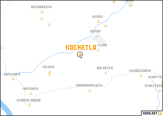
Nearby towns ::
Laka-Tyzhma (2.8km north east) //
Kizner (5.4km north) //
Baldeyka (4.6km south east) //
Yamushan-Kluchi (7.5km south) //
Yelokh (5.2km south west) //
Klyuch (5.5km south west) //
Nizhniy Tylovay (8.0km north east) //
Nizhnyaya Chab'ya (8.0km north east) //
Kizner (8.7km north) //
Sinyarka (8.8km north west) //
[all distances 'as the bird flies' and approximate] 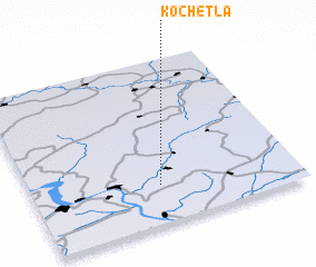 Places with similar names to Kochetla, Russia ::
Disclaimer :: Information on this page comes without warranty of any kind |
||
|
Where is Kochetla? Elevation and coordinates ::
Latitude (lat): 56°14'0"N Longitude (lon): 51°29'0"E
Elevation (approx.): 121m (map arrows pan, magnifying glasses zoom) |
||
|
Visiting Kochetla? Hotel/Accommodation ::
Book a hotel in Kochetla Travel Guide ::
Buy a travel guide for Russia rental cars ::
car rental offers GPS waypoint ::
download a GPX waypoint (PoI) of Kochetla for your GPS receiver
|
||