|
search place name
|
||
Kushnur (Nizhegorodskaya Oblast', Russia)Kushnur is a town in the Nizhegorodskaya Oblast' region of Russia. An overview map of the region around Kushnur is displayed below.
regional and 3d topo map of Kushnur, Russia ::

Nearby towns ::
Nesterska (1.2km north west) //
Pervoye Gusevo (2.6km north west) //
Krasnovka (3.0km south east) //
Kozlyanur (4.8km north) //
Purtovo (4.8km north) //
Bol'shoy Pinezh (6.3km south) //
Yermolino (6.7km north) //
Zen'kovo (4.3km south east) //
Kosari (5.9km north east) //
Lezhneno (4.7km west) //
Podoprelovo (8.6km north) //
Zavodskaya (6.3km south east) //
Korobeyniki (8.9km north) //
Kurzenya (7.4km south west) //
Nezhnur (9.4km south west) //
[all distances 'as the bird flies' and approximate] 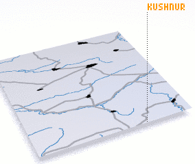 Places with similar names to Kushnur, Russia ::
// Kuchinarai (TH)
// Koshanur (RU)
// Koshnoruy (RU)
// Kashner (US)
// Kachnār (IN)
// Kachnāra (IN)
// Cochinera (MX)
// Gachānuri (PK)
// Kechi Unar (PK)
// Casianero (VE)
Disclaimer :: Information on this page comes without warranty of any kind |
||
|
Where is Kushnur? Elevation and coordinates ::
Latitude (lat): 57°0'25"N Longitude (lon): 46°42'35"E
Elevation (approx.): 143m (map arrows pan, magnifying glasses zoom) |
||
|
Visiting Kushnur? Hotel/Accommodation ::
Book a hotel in Kushnur Travel Guide ::
Buy a travel guide for Russia rental cars ::
car rental offers GPS waypoint ::
download a GPX waypoint (PoI) of Kushnur for your GPS receiver
|
||