|
search place name
|
||
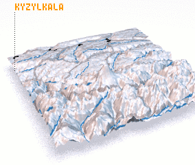
Kyzyl-Kala (Karachayevo-Cherkesiya, Russia)Kyzyl-Kala is a town in the Karachayevo-Cherkesiya region of Russia. An overview map of the region around Kyzyl-Kala is displayed below.
regional and 3d topo map of Kyzyl-Kala, Russia ::

Kyzyl-Kala airports ::
The nearest airport is MRV - Mineralnye Vody Mineralnyye Vody, located 91.6 km north east of Kyzyl-Kala.
Other airports nearby include STW - Stavropol Shpakovskoye (133.2 km north), Nearby towns ::
 Places with similar names to Kyzyl-Kala, Russia ::
// Güzeloğlu (TR)
// Kazlıgöl (TR)
// Kazlıgöl (TR)
// Kışlaoğlu (TR)
// Kızılcaali (TR)
// Kızılcalı (TR)
// Kızılkale (TR)
// Kızılkule (TR)
// Gozolokolo (RU)
// Kyzyl-Kala (UZ)
Disclaimer :: Information on this page comes without warranty of any kind |
||
|
Where is Kyzyl-Kala? Elevation and coordinates ::
Latitude (lat): 43°54'45"N Longitude (lon): 42°1'26"E
Elevation (approx.): 1128m (map arrows pan, magnifying glasses zoom) |
||
|
Visiting Kyzyl-Kala? Hotel/Accommodation ::
Book a hotel in Kyzyl-Kala Travel Guide ::
Buy a travel guide for Russia rental cars ::
car rental offers GPS waypoint ::
download a GPX waypoint (PoI) of Kyzyl-Kala for your GPS receiver
|
||