|
search place name
|
||
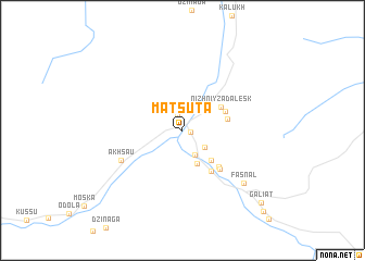
Matsuta (Severnaya Osetiya-Alaniya, Russia)Matsuta is a town in the Severnaya Osetiya-Alaniya region of Russia. An overview map of the region around Matsuta is displayed below.
regional and 3d topo map of Matsuta, Russia ::
Matsuta airports ::
The nearest airport is MRV - Mineralnye Vody Mineralnyye Vody, located 148.3 km north of Matsuta.
Nearby towns ::
Nizhniy Nar (0.6km east) //
Donifars (1.6km north) //
Faraskatta (2.4km south east) //
Makhchesk (2.7km south) //
Kamata (3.6km south) //
Tavitoz (3.7km south east) //
Nizhniy Zadalesk (3.8km north east) //
Khanaz (3.6km east) //
Verkhniy Zadalesk (3.8km north east) //
Vakats (4.7km south east) //
Kalnakhta (4.7km south east) //
Mastinoka (4.9km south east) //
Akhsau (5.5km south west) //
Fasnal (7.1km south east) //
Galiat (9.5km south east) //
Kamunta (10.3km south east) //
[all distances 'as the bird flies' and approximate]  Places with similar names to Matsuta, Russia ::
Disclaimer :: Information on this page comes without warranty of any kind |
||
|
Where is Matsuta? Elevation and coordinates ::
Latitude (lat): 42°59'20"N Longitude (lon): 43°46'28"E
Elevation (approx.): 1302m (map arrows pan, magnifying glasses zoom) |
||
|
Visiting Matsuta? Hotel/Accommodation ::
Book a hotel in Matsuta Travel Guide ::
Buy a travel guide for Russia rental cars ::
car rental offers GPS waypoint ::
download a GPX waypoint (PoI) of Matsuta for your GPS receiver
|
||