|
search place name
|
||
Mironegi (Novgorodskaya Oblast', Russia)Mironegi is a town in the Novgorodskaya Oblast' region of Russia. An overview map of the region around Mironegi is displayed below.
regional and 3d topo map of Mironegi, Russia ::
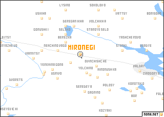
Nearby towns ::
Bortsovo (1.7km south west) //
Yel'chino (3.4km south) //
Ovinchishche (2.5km south east) //
Dubrovka (3.8km south) //
Berëzka (4.2km north west) //
Safronikha (4.7km south east) //
Nemchinova Gora (3.5km north west) //
Nekrasovichi (5.9km north) //
Sel'sko (5.9km north) //
Staroye Selo (5.9km north) //
Mironushka (4.7km south east) //
Yerëmina Gora (4.4km south west) //
Ugrivo (5.4km south west) //
Seredeya (7.5km south) //
Yeglino (7.5km north) //
Dereganikha (7.5km north) //
Bykovo (7.7km north) //
Volchikha (7.7km north) //
Pestovo (5.5km south west) //
Gagrino (9.0km south) //
Zagor'ye (5.9km south west) //
Polosy (7.9km south east) //
[all distances 'as the bird flies' and approximate] 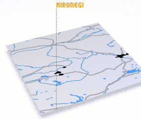 Places with similar names to Mironegi, Russia ::
Disclaimer :: Information on this page comes without warranty of any kind |
||
|
Where is Mironegi? Elevation and coordinates ::
Latitude (lat): 58°0'0"N Longitude (lon): 33°8'0"E
Elevation (approx.): 164m (map arrows pan, magnifying glasses zoom) |
||
|
Visiting Mironegi? Hotel/Accommodation ::
Book a hotel in Mironegi Travel Guide ::
Buy a travel guide for Russia rental cars ::
car rental offers GPS waypoint ::
download a GPX waypoint (PoI) of Mironegi for your GPS receiver
|
||