|
search place name
|
||
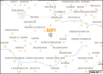
Sury (Orlovskaya Oblast', Russia)Sury is a town in the Orlovskaya Oblast' region of Russia. An overview map of the region around Sury is displayed below.
regional and 3d topo map of Sury, Russia ::
Sury airports ::
The nearest airport is BZK - Bryansk, located 151.7 km north west of Sury.
Nearby towns ::
Baranovskiy Lazavets (3.0km north) //
Staroye Gorokhovo (3.1km south) //
Filosofskiy Lazavets (2.7km north west) //
Novogorodskiy (4.3km north) //
Ol'gino (3.3km south east) //
Turgeneva (3.2km east) //
Ozërna (3.8km south west) //
Volodarskaya (5.4km south) //
Gorki (6.2km north) //
Koshelëvo (6.2km north) //
Annenskiy Lozovets (4.3km north west) //
Orlova Dacha (5.6km south west) //
Sadovaya (6.9km south) //
Podozërenka (5.2km south west) //
Koz'minskoye (8.2km north) //
Kalinnik (7.1km north west) //
Shusherovo (7.5km south east) //
Slobodka (8.2km north) //
Krasnaya Polyana (8.8km south) //
Kochkernik (6.4km north west) //
Glebovskiy (9.3km south) //
Priyatnoye (7.9km north east) //
Staraya Gnilusha (9.4km south west) //
Lovchikovo (9.5km south east) //
[all distances 'as the bird flies' and approximate]  Places with similar names to Sury, Russia ::
Disclaimer :: Information on this page comes without warranty of any kind |
||
|
Where is Sury? Elevation and coordinates ::
Latitude (lat): 52°34'42"N Longitude (lon): 36°10'12"E
Elevation (approx.): 213m (map arrows pan, magnifying glasses zoom) |
||
|
Visiting Sury? Hotel/Accommodation ::
Book a hotel in Sury Travel Guide ::
Buy a travel guide for Russia rental cars ::
car rental offers GPS waypoint ::
download a GPX waypoint (PoI) of Sury for your GPS receiver
|
||