|
search place name
|
||
Zady (Kostromskaya Oblast', Russia)Zady is a town in the Kostromskaya Oblast' region of Russia. An overview map of the region around Zady is displayed below.
regional and 3d topo map of Zady, Russia ::
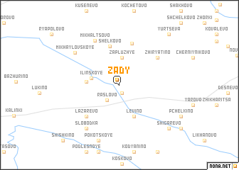
Nearby towns ::
Antipino (1.3km south) //
Raslovo (2.6km south west) //
Zapluzh'ye (4.3km north) //
Il'inskoye (2.6km north west) //
Dichevo (2.8km west) //
Levino (5.1km south) //
Shëlkovo (6.2km north) //
Belaya Reka (6.6km north) //
Lazarevo (5.7km south west) //
Zhiryatino (5.3km north east) //
Mikhal'tsovo (7.3km north) //
Slobodka (7.4km south) //
Zhdalova (7.4km south) //
Mikhaylovskoye (6.3km north west) //
Pokotskoye (8.9km south) //
Shigarëvo (8.0km south east) //
Yurtseva (9.0km north east) //
Shishkino (9.9km south west) //
[all distances 'as the bird flies' and approximate] 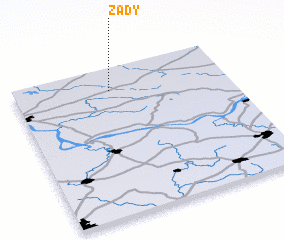 Places with similar names to Zady, Russia ::
Disclaimer :: Information on this page comes without warranty of any kind |
||
|
Where is Zady? Elevation and coordinates ::
Latitude (lat): 57°50'42"N Longitude (lon): 41°26'47"E
Elevation (approx.): 133m (map arrows pan, magnifying glasses zoom) |
||
|
Visiting Zady? Hotel/Accommodation ::
Book a hotel in Zady Travel Guide ::
Buy a travel guide for Russia rental cars ::
car rental offers GPS waypoint ::
download a GPX waypoint (PoI) of Zady for your GPS receiver
|
||