|
search place name
|
||
Bonneville (Alabama, United States - USA)Bonneville is a town in the Alabama region of United States - USA. An overview map of the region around Bonneville is displayed below.
regional and 3d topo map of Bonneville, United States - USA ::

Bonneville airports ::
The nearest airport is HUA - Redstone Aaf, located 29.6 km south east of Bonneville.
Other airports nearby include BHM - Birmingham Intl (143.4 km south), BNA - Nashville Intl (143.7 km north), CHA - Chattanooga Lovell Fld (159.6 km east), ANB - Anniston Metro (171.3 km south east), Nearby towns ::
Piney Chapel (1.0km north) //
Carey (3.3km north) //
Oakdale (3.6km south east) //
Alabama Fork (3.5km west) //
Oakdale Acres (4.1km south east) //
Hays Mill (4.9km north west) //
Brookwood Forest (5.7km south) //
Sardis Springs (4.7km east) //
Wigginsville (5.6km south) //
East Hampton (6.0km south) //
Lakewood (5.3km south west) //
Athens (5.8km south west) //
Hannah (6.7km south) //
Fairmount (7.2km south east) //
Bonnie Doone (8.4km south) //
Pinedale Acres (7.9km south west) //
Thach (9.1km north east) //
French Mill (10.3km south east) //
Oak Grove (10.9km north east) //
[all distances 'as the bird flies' and approximate] 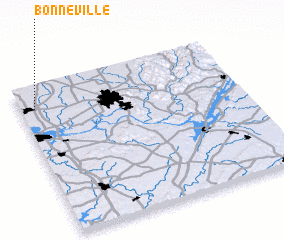 Places with similar names to Bonneville, United States - USA ::
// Bonfal (PH)
// Benevola (US)
// Booneville (US)
// Bonfol (CH)
// Booneville (US)
// Boonville (US)
// Boneville (US)
// Benville (US)
// Boonville (US)
// Bayneville (US)
Disclaimer :: Information on this page comes without warranty of any kind |
||
|
Where is Bonneville? Elevation and coordinates ::
Latitude (lat): 34°50'47"N Longitude (lon): 86°56'9"W
Elevation (approx.): 236m (map arrows pan, magnifying glasses zoom) |
||
|
Visiting Bonneville? Hotel/Accommodation ::
Book a hotel in Bonneville Travel Guide ::
rental cars ::
car rental offers GPS waypoint ::
download a GPX waypoint (PoI) of Bonneville for your GPS receiver
|
||