|
search place name
|
||
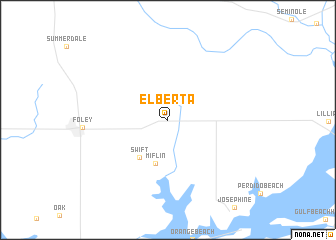
Elberta (Alabama, United States - USA)Elberta is a town in the Alabama region of United States - USA. An overview map of the region around Elberta is displayed below.
regional and 3d topo map of Elberta, United States - USA ::
Elberta airports ::
The nearest airport is NPA - Pensacola Nas, located 27.7 km east of Elberta.
Other airports nearby include PNS - Pensacola Rgnl (40.0 km east), BFM - Mobile Downtown (50.9 km north west), MOB - Mobile Rgnl (69.1 km north west), VPS - Valparaiso Eglin Afb (103.3 km east), Nearby towns ::
 Places with similar names to Elberta, United States - USA ::
// El Baïrat (MA)
// Ela Beridi (ER)
// Elberta (US)
// Elberta (US)
// Elbert (US)
// Elbart (DE)
// Elberta (US)
// El Barrito (PA)
// El Barrito (PA)
// Elberta (US)
Disclaimer :: Information on this page comes without warranty of any kind |
||
|
Where is Elberta? Elevation and coordinates ::
Latitude (lat): 30°24'51"N Longitude (lon): 87°35'52"W
Elevation (approx.): 25m (map arrows pan, magnifying glasses zoom) |
||
|
Visiting Elberta? Hotel/Accommodation ::
Book a hotel in Elberta Travel Guide ::
rental cars ::
car rental offers GPS waypoint ::
download a GPX waypoint (PoI) of Elberta for your GPS receiver
|
||