|
search place name
|
||
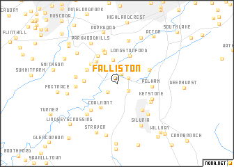
Falliston (Alabama, United States - USA)Falliston is a town in the Alabama region of United States - USA. An overview map of the region around Falliston is displayed below.
regional and 3d topo map of Falliston, United States - USA ::
Falliston airports ::
The nearest airport is BHM - Birmingham Intl, located 31.9 km north of Falliston.
Other airports nearby include ANB - Anniston Metro (98.9 km east), MXF - Montgomery Maxwell Afb (110.7 km south east), CBM - Colombus Columbus Afb (152.4 km west), HUA - Redstone Aaf (154.9 km north), Nearby towns ::
Tacoa (1.5km north) //
Roebuck (1.8km south west) //
Helena (1.7km north east) //
Calliston (1.9km south east) //
Elvira (3.8km north) //
Paramount (3.9km north east) //
Coalmont (4.4km south west) //
Southpointe (4.4km north west) //
Weeping Oaks (4.4km north west) //
Langston Ford (4.7km north) //
Whispering Oaks (4.6km north west) //
Shadywood (4.6km north west) //
High Point (5.2km north) //
Genery (4.6km north west) //
Cherokee Beach (4.5km west) //
Russet Woods (5.1km north west) //
Shades Run (5.3km north) //
Cahaba Valley Estates (4.7km north east) //
Pelham (4.7km east) //
Eden Ridge (5.5km north) //
Scottrock (5.5km south east) //
Mossboro (5.6km south west) //
Keystone (5.3km south east) //
Hardy (5.4km south east) //
Chestnut Glen (5.6km west) //
Highlands (5.6km west) //
Tulse (6.3km south west) //
Alabaster (6.5km south east) //
Mars Hill (7.1km north) //
[all distances 'as the bird flies' and approximate]  Places with similar names to Falliston, United States - USA ::
// Fowlstown (US)
// Filasţīn (EG)
// Valea Stînei (RO)
// Valea Stînei (RO)
// Valea Stînii (RO)
// Valea Stînii (RO)
// Valea Stînii (RO)
// Fallston (US)
// Fallston (US)
// Fallston (US)
Disclaimer :: Information on this page comes without warranty of any kind |
||
|
Where is Falliston? Elevation and coordinates ::
Latitude (lat): 33°17'22"N Longitude (lon): 86°51'36"W
Elevation (approx.): 146m (map arrows pan, magnifying glasses zoom) |
||
|
Visiting Falliston? Hotel/Accommodation ::
Book a hotel in Falliston Travel Guide ::
rental cars ::
car rental offers GPS waypoint ::
download a GPX waypoint (PoI) of Falliston for your GPS receiver
|
||