|
search place name
|
||
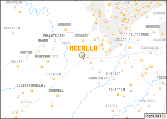
McCalla (Alabama, United States - USA)McCalla is a town in the Alabama region of United States - USA. An overview map of the region around McCalla is displayed below.
regional and 3d topo map of McCalla, United States - USA ::
McCalla airports ::
The nearest airport is BHM - Birmingham Intl, located 33.9 km north east of McCalla.
Other airports nearby include ANB - Anniston Metro (110.7 km east), MXF - Montgomery Maxwell Afb (123.1 km south east), CBM - Colombus Columbus Afb (136.8 km west), HUA - Redstone Aaf (150.6 km north), Nearby towns ::
Flint Hill (1.0km north east) //
Hickory Grove (1.5km south east) //
Pleasant Hill (2.6km south east) //
Pine Crest (3.6km north east) //
Rockdale (3.4km east) //
McAdory (4.3km north) //
Loveless Park (4.0km south east) //
Chinn (4.1km north west) //
Mobile Junction (4.1km north east) //
Thomas Acres (4.6km north east) //
Dolonar (5.0km north east) //
Rice (4.6km north east) //
Eastern Valley (4.4km east) //
Glen Hills (4.7km north east) //
Shady Brook (4.5km north east) //
Lakewood Estate (5.1km north east) //
Old Jonesboro (5.7km north east) //
Skyview (5.6km north east) //
Raimund (5.3km north east) //
Summit Farm (6.0km south east) //
Jonesboro (6.1km north east) //
West Highlands (6.8km north) //
West Lake Highlands (6.7km north east) //
Oakwood (6.6km north east) //
Blue Creek (6.3km north west) //
Valley Creek (6.9km north west) //
Virginia (7.5km north west) //
Black Diamond (6.7km west) //
Smithson (7.2km south east) //
[all distances 'as the bird flies' and approximate]  Places with similar names to McCalla, United States - USA ::
Disclaimer :: Information on this page comes without warranty of any kind |
||
|
Where is McCalla? Elevation and coordinates ::
Latitude (lat): 33°20'55"N Longitude (lon): 87°0'51"W
Elevation (approx.): 160m (map arrows pan, magnifying glasses zoom) |
||
|
Visiting McCalla? Hotel/Accommodation ::
Book a hotel in McCalla Travel Guide ::
rental cars ::
car rental offers GPS waypoint ::
download a GPX waypoint (PoI) of McCalla for your GPS receiver
|
||