|
search place name
|
||
Sellers Crossroads (Alabama, United States - USA)Sellers Crossroads is a town in the Alabama region of United States - USA. An overview map of the region around Sellers Crossroads is displayed below.
regional and 3d topo map of Sellers Crossroads, United States - USA ::

Sellers Crossroads airports ::
The nearest airport is MXF - Montgomery Maxwell Afb, located 74.5 km north west of Sellers Crossroads.
Other airports nearby include DHN - Dothan Rgnl (76.2 km south), LSF - Fort Benning Lawson Aaf (83.5 km north east), CEW - Crestview Bob Sikes (149.6 km south west), VPS - Valparaiso Eglin Afb (179.1 km south west), Nearby towns ::
Omega (3.5km north west) //
Blues Old Stand (4.8km north east) //
Perote (4.8km east) //
Corinth (5.9km south) //
Inverness (6.5km north) //
Saco (6.2km west) //
Jenkins Crossroads (7.9km north) //
Sandfield (7.5km south west) //
Postoak (7.8km north west) //
Scottland (9.0km north east) //
Tanyard (9.0km south east) //
Catalpa (11.3km south west) //
[all distances 'as the bird flies' and approximate] 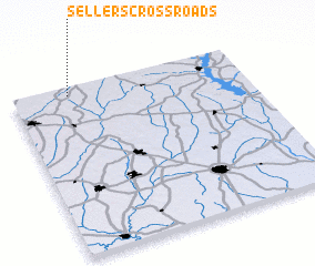 Places with similar names to Sellers Crossroads, United States - USA ::
// Saylors Crossroads (US)
Disclaimer :: Information on this page comes without warranty of any kind |
||
|
Where is Sellers Crossroads? Elevation and coordinates ::
Latitude (lat): 31°57'25"N Longitude (lon): 85°45'19"W
Elevation (approx.): 168m (map arrows pan, magnifying glasses zoom) |
||
|
Visiting Sellers Crossroads? Hotel/Accommodation ::
Book a hotel in Sellers Crossroads Travel Guide ::
rental cars ::
car rental offers GPS waypoint ::
download a GPX waypoint (PoI) of Sellers Crossroads for your GPS receiver
|
||