|
search place name
|
||
Spring Valley (Alabama, United States - USA)Spring Valley is a town in the Alabama region of United States - USA. An overview map of the region around Spring Valley is displayed below.
regional and 3d topo map of Spring Valley, United States - USA ::

Spring Valley airports ::
The nearest airport is HUA - Redstone Aaf, located 85.4 km east of Spring Valley.
Other airports nearby include CBM - Colombus Columbus Afb (135.8 km south west), BHM - Birmingham Intl (145.1 km south east), MKL - Jackson Mc Kellar Sipes Rgnl (158.0 km north west), BNA - Nashville Intl (183.8 km north east), Nearby towns ::
Hobgood (6.6km north) //
Emco-Listerhill Junction (6.7km north) //
Cave Spring (8.1km north) //
Houston Corner (8.3km north) //
Norala Junction (8.0km north west) //
White House Springs (7.1km west) //
Colbert Heights (7.1km west) //
Colonial Heights (8.9km north west) //
Littleville (9.2km south west) //
Belview Heights (9.4km north west) //
[all distances 'as the bird flies' and approximate] 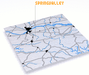 Places with similar names to Spring Valley, United States - USA ::
// Spring Villa (US)
// Springville (US)
// Spring Valley (US)
// Spring Valley (US)
// Spring Valley (US)
// Spring Valley (US)
// Spring Valley (US)
// Spring Valley (US)
// Springville (US)
// Springville (US)
Disclaimer :: Information on this page comes without warranty of any kind |
||
|
Where is Spring Valley? Elevation and coordinates ::
Latitude (lat): 34°39'24"N Longitude (lon): 87°37'0"W
Elevation (approx.): 159m (map arrows pan, magnifying glasses zoom) |
||
|
Visiting Spring Valley? Hotel/Accommodation ::
Book a hotel in Spring Valley Travel Guide ::
rental cars ::
car rental offers GPS waypoint ::
download a GPX waypoint (PoI) of Spring Valley for your GPS receiver
|
||