|
search place name
|
||
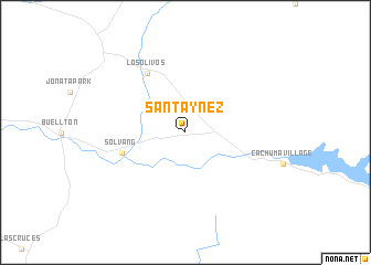
Santa Ynez (California, United States - USA)Santa Ynez is a town in the California region of United States - USA. An overview map of the region around Santa Ynez is displayed below.
regional and 3d topo map of Santa Ynez, United States - USA ::
Santa Ynez airports ::
The nearest airport is VBG - Lompoc Vandenberg Afb, located 48.3 km west of Santa Ynez.
Other airports nearby include NTD - Point Mugu Nas (103.8 km south east), BFL - Bakersfield Meadows Fld (130.2 km north east), BUR - Burbank Bob Hope (164.7 km east), LAX - Los Angeles Intl (171.0 km south east), Nearby towns ::
Ballard (3.9km north west) //
Solvang (5.7km west) //
Los Olivos (6.7km north west) //
[all distances 'as the bird flies' and approximate] 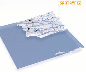 Places with similar names to Santa Ynez, United States - USA ::
// Santa Inês (BR)
// Santa Inês (BR)
// Santa Inês (BR)
// Santo Inácio (BR)
// Santo Inácio (BR)
// Santo Inácio (BR)
// Santo Inácio (BR)
// Santo Inácio (BR)
// Santo Inácio (BR)
// Santins (PT)
Disclaimer :: Information on this page comes without warranty of any kind |
||
|
Where is Santa Ynez? Elevation and coordinates ::
Latitude (lat): 34°36'52"N Longitude (lon): 120°4'44"W
Elevation (approx.): 188m (map arrows pan, magnifying glasses zoom) |
||
|
Visiting Santa Ynez? Hotel/Accommodation ::
Book a hotel in Santa Ynez Travel Guide ::
rental cars ::
car rental offers GPS waypoint ::
download a GPX waypoint (PoI) of Santa Ynez for your GPS receiver
|
||