|
search place name
|
||
Timber Trails (California, United States - USA)Timber Trails is a town in the California region of United States - USA. An overview map of the region around Timber Trails is displayed below.
regional and 3d topo map of Timber Trails, United States - USA ::

Timber Trails airports ::
The nearest airport is BAB - Marysville Beale Afb, located 36.2 km west of Timber Trails.
Other airports nearby include MCC - Sacramento Mc Clellan Afld (71.6 km south west), SMF - Sacramento Intl (77.6 km south west), RIU - Rancho Murieta (84.7 km south), SAC - Sacramento Executive (90.6 km south west), Nearby towns ::
Evergreen Estates (0.6km south) //
Echo Ridge Estates (0.6km west) //
Bella Vista Park (0.7km south west) //
Glenbrook (1.0km south east) //
Echo Ridge Trails (1.1km west) //
Town Talk (1.3km south east) //
Spring Hill (1.8km south) //
Gold Flat (1.7km east) //
Cypress Hill (2.6km south west) //
Hills Flat (2.8km south) //
Banner Crest (2.6km south east) //
Sahl Court (2.6km south west) //
Alta Vista Park (3.0km south west) //
Sunrise Heights (3.0km south west) //
Grass Valley (3.6km south west) //
Alta Hill (3.5km south west) //
Sierra Vista Park (3.5km south west) //
Forest Knolls (3.5km east) //
Union Hill (4.8km south) //
White Spot (4.6km north east) //
The Oaks (4.5km south west) //
Boston Ravine (5.0km south west) //
Cedar Ridge (5.9km south) //
Sunset View (5.0km south west) //
Kres (6.2km south east) //
Leduc Acres (6.6km south) //
Cedar Crest (6.5km south east) //
Highland Park (7.2km south) //
Willow Valley (6.0km north east) //
[all distances 'as the bird flies' and approximate] 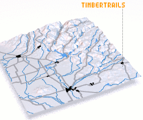 Places with similar names to Timber Trails, United States - USA ::
// Timber Trails (US)
// Timber Trails (US)
Disclaimer :: Information on this page comes without warranty of any kind |
||
|
Where is Timber Trails? Elevation and coordinates ::
Latitude (lat): 39°14'55"N Longitude (lon): 121°2'35"W
Elevation (approx.): 879m (map arrows pan, magnifying glasses zoom) |
||
|
Visiting Timber Trails? Hotel/Accommodation ::
Book a hotel in Timber Trails Travel Guide ::
rental cars ::
car rental offers GPS waypoint ::
download a GPX waypoint (PoI) of Timber Trails for your GPS receiver
|
||