|
search place name
|
||
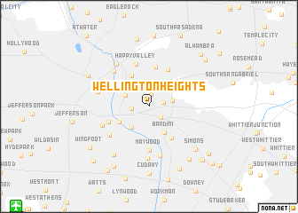
Wellington Heights (California, United States - USA)Wellington Heights is a town in the California region of United States - USA. An overview map of the region around Wellington Heights is displayed below.
regional and 3d topo map of Wellington Heights, United States - USA ::
nearby GPS traces from timatio ::
Wellington Heights airports ::
The nearest airport is HHR - Jack Northrop Fld Hawthorne Muni, located 18.7 km south west of Wellington Heights.
Other airports nearby include LAX - Los Angeles Intl (23.1 km south west), BUR - Burbank Bob Hope (24.3 km north west), LGB - Long Beach (24.4 km south), SNA - Santa Ana John Wayne Arpt Orange Co (49.6 km south east), Nearby towns ::
City Terrace (1.6km north) //
Belvedere (1.6km east) //
East Los Angeles (1.8km south east) //
Boyle Heights (1.8km west) //
Maravilla Housing Project (2.5km east) //
Brooklyn Heights (2.8km north west) //
Hobart (3.2km south west) //
Bandini (3.7km south east) //
Soto Street Junction (3.6km south west) //
Lincoln Heights (4.2km north west) //
Commerce (4.6km south east) //
El Sereno (5.1km north) //
Taylor Junction (4.6km north west) //
Aurant (5.1km north east) //
Maywood (5.5km south) //
Butte Street Junction (4.7km south west) //
Mission Junction (4.9km north west) //
Happy Valley (5.5km north) //
Vernon (5.4km south west) //
Glendale Junction (5.7km north west) //
Walker (6.3km south) //
Clement Junction (5.5km south west) //
Bell (6.5km south) //
Los Angeles (5.6km west) //
Dayton Avenue (6.3km north west) //
Huntington Park (7.1km south west) //
Simons (7.3km south east) //
Laguna (7.8km south east) //
Cudahy (8.4km south) //
[all distances 'as the bird flies' and approximate]  Places with similar names to Wellington Heights, United States - USA ::
Disclaimer :: Information on this page comes without warranty of any kind |
||
|
Where is Wellington Heights? Elevation and coordinates ::
Latitude (lat): 34°2'10"N Longitude (lon): 118°11'5"W
Elevation (approx.): 98m (map arrows pan, magnifying glasses zoom) |
||
|
Visiting Wellington Heights? Hotel/Accommodation ::
Book a hotel in Wellington Heights Travel Guide ::
rental cars ::
car rental offers GPS waypoint ::
download a GPX waypoint (PoI) of Wellington Heights for your GPS receiver
|
||