|
search place name
|
||
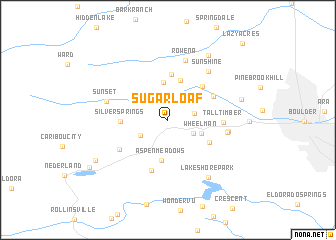
Sugarloaf (Colorado, United States - USA)Sugarloaf is a town in the Colorado region of United States - USA. An overview map of the region around Sugarloaf is displayed below.
regional and 3d topo map of Sugarloaf, United States - USA ::
Sugarloaf airports ::
The nearest airport is DEN - Denver Intl, located 65.0 km east of Sugarloaf.
Other airports nearby include BKF - Buckley Afb (66.1 km south east), CYS - Cheyenne Rgnl Jerry Olson Fld (136.1 km north), COS - City Of Colorado Springs Muni (147.6 km south east), PUB - Pueblo Memorial Pueblo Mem (207.3 km south east), Nearby towns ::
Wallstreet (2.8km north east) //
Mountain Meadows (2.4km east) //
Sunnyside (2.6km south east) //
Switzerland Park (2.9km south west) //
Wheelman (3.2km south east) //
Gold Run (4.2km north) //
Aspen Meadows (4.5km south) //
Summerville (4.6km north) //
Gold Hill (5.1km north) //
Silver Springs (4.0km west) //
Magnolia (4.4km south east) //
Salina (4.8km north east) //
Crisman (4.7km north east) //
Ridgewood (5.9km south) //
Tall Timber (4.7km east) //
Saint Ann Highlands (5.3km south west) //
Silver Spruce (5.2km east) //
El Vado (5.3km east) //
Rowena (6.8km north) //
Sunshine (6.4km north east) //
Sunset (5.7km west) //
Lake Shore Park (7.3km south east) //
Glendale (8.0km north east) //
Seven Hills (6.7km east) //
Bonanza Mountain Estates (7.7km south west) //
Whispering Pine (8.5km south west) //
Lazy Acres (10.6km north east) //
[all distances 'as the bird flies' and approximate] 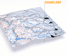 Places with similar names to Sugarloaf, United States - USA ::
// Sugarloaf (US)
// Sugarloaf (US)
// Sugar Loaf (US)
// Sugar Loaf (US)
// Sugarloaf (US)
// Sugar Loaf (US)
// Sugar Loaf (BS)
// Sugar Loaf (BS)
// Skrylovo (RU)
// Skärlöv (SE)
Disclaimer :: Information on this page comes without warranty of any kind |
||
|
Where is Sugarloaf? Elevation and coordinates ::
Latitude (lat): 40°1'1"N Longitude (lon): 105°24'24"W
Elevation (approx.): 2378m (map arrows pan, magnifying glasses zoom) |
||
|
Visiting Sugarloaf? Hotel/Accommodation ::
Book a hotel in Sugarloaf Travel Guide ::
rental cars ::
car rental offers GPS waypoint ::
download a GPX waypoint (PoI) of Sugarloaf for your GPS receiver
|
||