|
search place name
|
||
Naaman (Delaware, United States - USA)Naaman is a town in the Delaware region of United States - USA. An overview map of the region around Naaman is displayed below.
regional and 3d topo map of Naaman, United States - USA ::

Naaman airports ::
The nearest airport is PHL - Philadelphia Intl, located 18.6 km east of Naaman.
Other airports nearby include ILG - Wilmington New Castle (20.3 km south west), NXX - Willow Grove Nas Jrb (49.9 km north east), MIV - Millville Muni (58.8 km south east), APG - Aberdeen Phillips Aaf (73.1 km south west), Nearby towns ::
Aniline Village (0.2km north east) //
Worthland (0.6km south west) //
Addick Estates (1.1km south west) //
Whites Village (1.3km north west) //
Riverview Gardens (1.6km north west) //
Boothwyn (2.0km north) //
Stockdale (1.8km south west) //
Claymont (1.9km south west) //
Princeton Estates (1.8km north west) //
Carpenter (1.9km west) //
Ogden (2.2km north west) //
Linwood (2.2km north east) //
Ashbourne Hills (2.1km west) //
Marcus Hook (2.3km east) //
Overlook Colony (2.3km west) //
Valley Run (2.3km west) //
Riverside (2.6km south west) //
Radnor Green (2.5km west) //
Longview Farms (2.5km west) //
Claymont Addition (2.7km south west) //
Darley Woods (2.6km west) //
Gardendale (3.4km north) //
Claymont Heights (2.9km south west) //
Indian Field (2.8km west) //
Trainer (3.1km north east) //
Twin Oaks (3.5km north east) //
Grubbs Landing (3.6km south west) //
Rolling Park (3.5km south west) //
Highland Woods (3.2km west) //
[all distances 'as the bird flies' and approximate] 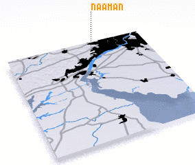 Places with similar names to Naaman, United States - USA ::
Disclaimer :: Information on this page comes without warranty of any kind |
||
|
Where is Naaman? Elevation and coordinates ::
Latitude (lat): 39°48'43"N Longitude (lon): 75°26'39"W
Elevation (approx.): 10m (map arrows pan, magnifying glasses zoom) |
||
|
Visiting Naaman? Hotel/Accommodation ::
Book a hotel in Naaman Travel Guide ::
rental cars ::
car rental offers GPS waypoint ::
download a GPX waypoint (PoI) of Naaman for your GPS receiver
|
||