|
search place name
|
||
White Horse Farm (Delaware, United States - USA)White Horse Farm is a town in the Delaware region of United States - USA. An overview map of the region around White Horse Farm is displayed below.
regional and 3d topo map of White Horse Farm, United States - USA ::

White Horse Farm airports ::
The nearest airport is SBY - Salisbury Ocean City Wicomico Rgnl, located 45.0 km south west of White Horse Farm.
Other airports nearby include WWD - Wildwood Cape May Co (46.2 km north east), DOV - Dover Afb (52.0 km north), MIV - Millville Muni (76.7 km north), ACY - Atlantic City Intl (103.2 km north east), Nearby towns ::
Andersons Corner (1.0km north west) //
Danfield Acres (2.0km south east) //
Hollyville (2.4km south east) //
Hollyville Acres (2.0km east) //
Indian Mission (2.6km south east) //
Shady Rest Park (3.1km north) //
Cool Spring Manor (3.1km north) //
Cool Spring Farms Mobile Home Park (3.7km north) //
Cool Spring Farms (3.8km north) //
Hollymount (3.3km south east) //
Avalon Park Mobile Home Park (3.9km south) //
Holly Leaf Estates Mobile Home Park (4.2km south) //
Patterson Place Mobile Home Park (4.3km south) //
Fairmount (3.9km south east) //
Cool Spring (4.5km north) //
Lazy Lake (4.8km north) //
Beaver Dam Acres (3.8km east) //
Pine Lake Development (4.3km south west) //
Harbeson (4.6km north west) //
Log Cabin Mobile Home Park (5.2km north) //
Arabian Acres (5.4km north east) //
Arbre Park Mobile Home Park (4.8km north east) //
Conley Chapel Village Mobile Home Park (4.7km east) //
Deerwood (5.2km north west) //
Springfield Crossroads (4.9km west) //
Briarwood Manor (5.2km north west) //
Kawan Acres (5.3km south west) //
Lochwood (5.1km east) //
Pinetown (6.5km north east) //
[all distances 'as the bird flies' and approximate] 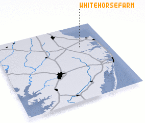 Places with similar names to White Horse Farm, United States - USA :: Disclaimer :: Information on this page comes without warranty of any kind |
||
|
Where is White Horse Farm? Elevation and coordinates ::
Latitude (lat): 38°41'30"N Longitude (lon): 75°15'12"W
Elevation (approx.): 11m (map arrows pan, magnifying glasses zoom) |
||
|
Visiting White Horse Farm? Hotel/Accommodation ::
Book a hotel in White Horse Farm Travel Guide ::
rental cars ::
car rental offers GPS waypoint ::
download a GPX waypoint (PoI) of White Horse Farm for your GPS receiver
|
||