|
search place name
|
||
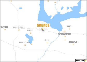
Sneads (Florida, United States - USA)Sneads is a town in the Florida region of United States - USA. An overview map of the region around Sneads is displayed below.
regional and 3d topo map of Sneads, United States - USA ::
Sneads airports ::
The nearest airport is TLH - Tallahassee Rgnl, located 65.0 km south east of Sneads.
Other airports nearby include DHN - Dothan Rgnl (84.5 km north west), PAM - Panama City Tyndall Afb (94.4 km south west), CEW - Crestview Bob Sikes (153.2 km west), VPS - Valparaiso Eglin Afb (155.5 km west), Nearby towns ::
Sinai (5.3km south) //
Inwood (4.8km west) //
Ocheesee Gardens (7.1km south west) //
Shady Grove (9.2km south west) //
[all distances 'as the bird flies' and approximate] 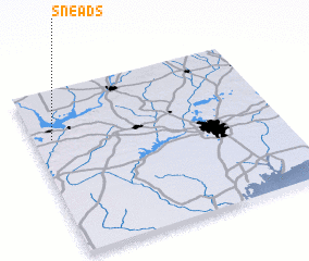 Places with similar names to Sneads, United States - USA ::
Disclaimer :: Information on this page comes without warranty of any kind |
||
|
Where is Sneads? Elevation and coordinates ::
Latitude (lat): 30°42'27"N Longitude (lon): 84°55'28"W
Elevation (approx.): 41m (map arrows pan, magnifying glasses zoom) |
||
|
Visiting Sneads? Hotel/Accommodation ::
Book a hotel in Sneads Travel Guide ::
rental cars ::
car rental offers GPS waypoint ::
download a GPX waypoint (PoI) of Sneads for your GPS receiver
|
||