|
search place name
|
||
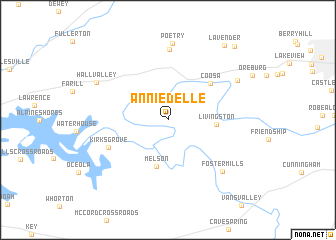
Anniedelle (Georgia, United States - USA)Anniedelle is a town in the Georgia region of United States - USA. An overview map of the region around Anniedelle is displayed below.
regional and 3d topo map of Anniedelle, United States - USA ::
Anniedelle airports ::
The nearest airport is ANB - Anniston Metro, located 81.8 km south west of Anniedelle.
Other airports nearby include MGE - Marietta Dobbins Arb (Atlanta Nas) (88.0 km east), CHA - Chattanooga Lovell Fld (92.4 km north), ATL - Hartsfield Jackson Atlanta Intl (110.4 km south east), HUA - Redstone Aaf (128.9 km north west), Nearby towns ::
Melson (5.3km south) //
Livingston (4.5km east) //
Coosa (5.7km north east) //
Kirks Grove (6.2km south west) //
Sprite (7.9km north) //
Foster Mills (7.6km south east) //
Poetry (8.6km north) //
Krannert (7.8km north east) //
Hall Valley (7.9km north west) //
Lavender (9.8km north east) //
Bone (10.2km north east) //
[all distances 'as the bird flies' and approximate] 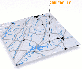 Places with similar names to Anniedelle, United States - USA ::
Disclaimer :: Information on this page comes without warranty of any kind |
||
|
Where is Anniedelle? Elevation and coordinates ::
Latitude (lat): 34°13'3"N Longitude (lon): 85°23'51"W
Elevation (approx.): 176m (map arrows pan, magnifying glasses zoom) |
||
|
Visiting Anniedelle? Hotel/Accommodation ::
Book a hotel in Anniedelle Travel Guide ::
rental cars ::
car rental offers GPS waypoint ::
download a GPX waypoint (PoI) of Anniedelle for your GPS receiver
|
||