|
search place name
|
||
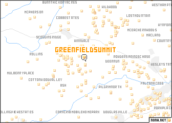
Greenfield Summit (Georgia, United States - USA)Greenfield Summit is a town in the Georgia region of United States - USA. An overview map of the region around Greenfield Summit is displayed below.
regional and 3d topo map of Greenfield Summit, United States - USA ::
Greenfield Summit airports ::
The nearest airport is MGE - Marietta Dobbins Arb (Atlanta Nas), located 27.5 km east of Greenfield Summit.
Other airports nearby include ATL - Hartsfield Jackson Atlanta Intl (43.0 km south east), ANB - Anniston Metro (102.1 km west), CHA - Chattanooga Lovell Fld (135.3 km north), MCN - Macon Middle Georgia Rgnl (168.5 km south east), Nearby towns ::
Spring Ridge Estates (0.6km south) //
Nebo Place (0.9km south) //
Fleetwood Hills (1.7km north west) //
Lake Swan (1.8km south west) //
Swan Lake (2.0km south west) //
Green Meadows (2.2km south) //
The Highlands (2.3km south) //
Old Davis Mill Estates (2.3km south west) //
Nebo Gardens (2.5km south west) //
Country Club Estates (2.8km south) //
Gordon Estates (2.5km west) //
Campground School Estates (2.7km west) //
Joseph Estates (2.7km west) //
Winndale (3.5km north) //
Forest Echo (3.5km north) //
Coppermine Estates (3.7km north) //
Nebo (3.4km south west) //
Heritage Estates (3.5km north west) //
Oak Creek (3.3km west) //
Sudie (3.3km west) //
Hartfield Estates (3.4km west) //
Mill Creek Place (4.1km south) //
Quail Run East (3.6km west) //
Home Place Acres (3.5km west) //
Honeysuckle Plantation (3.6km west) //
Pine Forest (3.6km west) //
Meadowbrook (3.8km south west) //
Ponderosa Estates (4.1km north west) //
Victoria Cove (3.8km west) //
[all distances 'as the bird flies' and approximate]  Places with similar names to Greenfield Summit, United States - USA :: Disclaimer :: Information on this page comes without warranty of any kind |
||
|
Where is Greenfield Summit? Elevation and coordinates ::
Latitude (lat): 33°51'39"N Longitude (lon): 84°48'22"W
Elevation (approx.): 345m (map arrows pan, magnifying glasses zoom) |
||
|
Visiting Greenfield Summit? Hotel/Accommodation ::
Book a hotel in Greenfield Summit Travel Guide ::
rental cars ::
car rental offers GPS waypoint ::
download a GPX waypoint (PoI) of Greenfield Summit for your GPS receiver
|
||