|
search place name
|
||
Jones Bridge Landing (Georgia, United States - USA)Jones Bridge Landing is a town in the Georgia region of United States - USA. An overview map of the region around Jones Bridge Landing is displayed below.
regional and 3d topo map of Jones Bridge Landing, United States - USA ::

Jones Bridge Landing airports ::
The nearest airport is MGE - Marietta Dobbins Arb (Atlanta Nas), located 28.9 km west of Jones Bridge Landing.
Other airports nearby include ATL - Hartsfield Jackson Atlanta Intl (44.1 km south west), CHA - Chattanooga Lovell Fld (146.8 km north west), AND - Andersen Anderson Rgnl (149.7 km east), MCN - Macon Middle Georgia Rgnl (153.7 km south), Nearby towns ::
North River Crossing (2.0km west) //
Peachtree Station (2.2km south west) //
Scotts Mill (2.3km south east) //
Peachtree Corners (2.6km south) //
Berkeley Lake (3.1km east) //
Warsaw (3.7km north east) //
Neely Farm (3.6km south west) //
Peachtree Forest (4.0km south west) //
The Corners (4.7km south west) //
Chattahoochee Station (4.4km south west) //
Fouts Corner (4.7km south west) //
Norcross Mobile Home City (5.1km south east) //
Norcross (5.9km south) //
Pittman (5.1km south east) //
Glen Leaf (5.9km south west) //
Elmside Village (5.8km south west) //
Overlook (6.0km south west) //
Edgemoor (6.1km south east) //
River Bluff (5.6km south west) //
Newtown (5.7km north west) //
Berkeley Manor (5.8km south east) //
Chelsea Park (6.4km south west) //
Covered Bridge (6.0km south east) //
Lockridge Forest (6.2km south west) //
Sheffield Forest (7.2km south) //
Berkeley Hills (7.1km south east) //
Horseshoe Bend (6.5km west) //
Mechanicsville (7.7km south) //
Oakbrook Station (7.7km south) //
[all distances 'as the bird flies' and approximate] 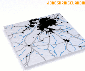 Places with similar names to Jones Bridge Landing, United States - USA :: Disclaimer :: Information on this page comes without warranty of any kind |
||
|
Where is Jones Bridge Landing? Elevation and coordinates ::
Latitude (lat): 33°59'37"N Longitude (lon): 84°13'5"W
Elevation (approx.): 296m (map arrows pan, magnifying glasses zoom) |
||
|
Visiting Jones Bridge Landing? Hotel/Accommodation ::
Book a hotel in Jones Bridge Landing Travel Guide ::
rental cars ::
car rental offers GPS waypoint ::
download a GPX waypoint (PoI) of Jones Bridge Landing for your GPS receiver
|
||