|
search place name
|
||
Moreland (Georgia, United States - USA)Moreland is a town in the Georgia region of United States - USA. An overview map of the region around Moreland is displayed below.
regional and 3d topo map of Moreland, United States - USA ::

Moreland airports ::
The nearest airport is ATL - Hartsfield Jackson Atlanta Intl, located 50.0 km north east of Moreland.
Other airports nearby include MGE - Marietta Dobbins Arb (Atlanta Nas) (73.5 km north), ANB - Anniston Metro (106.8 km west), LSF - Fort Benning Lawson Aaf (107.3 km south), MCN - Macon Middle Georgia Rgnl (123.6 km south east), Nearby towns ::
Saint Charles (2.1km south) //
Smith City (2.7km south) //
Bexton (3.9km south east) //
Oaklawn (4.9km north) //
Quail Hollow Mobile Home Park (5.7km north) //
East Newnan (7.2km north) //
Stephens Crossroad (6.2km north west) //
Raymond (7.6km north east) //
Luthersville (8.8km south) //
Grantville (8.6km south west) //
Smokey Acres (9.6km north west) //
Pine Hills (10.3km north west) //
[all distances 'as the bird flies' and approximate] 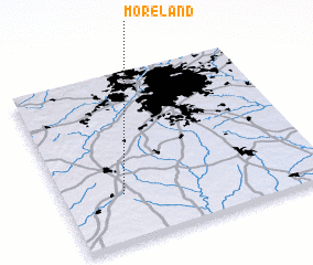 Places with similar names to Moreland, United States - USA ::
// Moreland (US)
// Maria Elend (AT)
// Maria Ellend (AT)
// Moreland (US)
// Marland (US)
// Marlanta (US)
// Moreland (US)
// Maryland (US)
// Mooreland (US)
// Morland (US)
Disclaimer :: Information on this page comes without warranty of any kind |
||
|
Where is Moreland? Elevation and coordinates ::
Latitude (lat): 33°17'12"N Longitude (lon): 84°46'4"W
Elevation (approx.): 288m (map arrows pan, magnifying glasses zoom) |
||
|
Visiting Moreland? Hotel/Accommodation ::
Book a hotel in Moreland Travel Guide ::
rental cars ::
car rental offers GPS waypoint ::
download a GPX waypoint (PoI) of Moreland for your GPS receiver
|
||