|
search place name
|
||
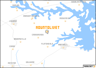
Mount Olivet (Georgia, United States - USA)Mount Olivet is a town in the Georgia region of United States - USA. An overview map of the region around Mount Olivet is displayed below.
regional and 3d topo map of Mount Olivet, United States - USA ::
Mount Olivet airports ::
The nearest airport is AND - Andersen Anderson Rgnl, located 27.5 km north east of Mount Olivet.
Other airports nearby include AGS - Bush Field Augusta Rgnl At Bush Fld (148.3 km south east), MGE - Marietta Dobbins Arb (Atlanta Nas) (151.1 km west), ATL - Hartsfield Jackson Atlanta Intl (157.9 km south west), CAE - Colombia Columbia Metropolitan (179.5 km east), Nearby towns ::
Maretts (2.5km north) //
Cross Roads (3.5km south west) //
Flat Shoals (5.0km south) //
Shoal Creek (6.3km north west) //
Hartwell (7.2km south east) //
Reed Creek (7.5km north east) //
Parkertown Mill (8.0km north west) //
Parkertown (8.1km north west) //
[all distances 'as the bird flies' and approximate]  Places with similar names to Mount Olivet, United States - USA ::
// Mount Olivet (US)
// Monte Olivete (ES)
// Mount Olivet (US)
// Mount Olivet (US)
// Mount Olivet (US)
// Mount Olivet (US)
// Montolivet (FR)
// Mount Olivet (US)
// Mount Olivet (US)
// Mount Lofty (AU)
Disclaimer :: Information on this page comes without warranty of any kind |
||
|
Where is Mount Olivet? Elevation and coordinates ::
Latitude (lat): 34°24'1"N Longitude (lon): 82°59'8"W
Elevation (approx.): 264m (map arrows pan, magnifying glasses zoom) |
||
|
Visiting Mount Olivet? Hotel/Accommodation ::
Book a hotel in Mount Olivet Travel Guide ::
rental cars ::
car rental offers GPS waypoint ::
download a GPX waypoint (PoI) of Mount Olivet for your GPS receiver
|
||