|
search place name
|
||
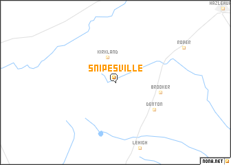
Snipesville (Georgia, United States - USA)Snipesville is a town in the Georgia region of United States - USA. An overview map of the region around Snipesville is displayed below.
regional and 3d topo map of Snipesville, United States - USA ::
Snipesville airports ::
The nearest airport is VAD - Valdosta Moody Afb, located 97.5 km south west of Snipesville.
Other airports nearby include WRB - Macon Robins Afb (125.6 km north west), MCN - Macon Middle Georgia Rgnl (133.5 km north west), SAV - Savannah Hilton Head Intl (152.0 km east), SVN - Hunter Aaf (154.4 km east), Nearby towns ::
 Places with similar names to Snipesville, United States - USA :: Disclaimer :: Information on this page comes without warranty of any kind |
||
|
Where is Snipesville? Elevation and coordinates ::
Latitude (lat): 31°45'42"N Longitude (lon): 82°45'4"W
Elevation (approx.): 90m (map arrows pan, magnifying glasses zoom) |
||
|
Visiting Snipesville? Hotel/Accommodation ::
Book a hotel in Snipesville Travel Guide ::
rental cars ::
car rental offers GPS waypoint ::
download a GPX waypoint (PoI) of Snipesville for your GPS receiver
|
||