|
search place name
|
||
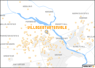
Village At Watervale (Georgia, United States - USA)Village At Watervale is a town in the Georgia region of United States - USA. An overview map of the region around Village At Watervale is displayed below.
regional and 3d topo map of Village At Watervale, United States - USA ::
Village At Watervale airports ::
The nearest airport is AGS - Bush Field Augusta Rgnl At Bush Fld, located 20.8 km south east of Village At Watervale.
Other airports nearby include CAE - Colombia Columbia Metropolitan (98.0 km north east), AND - Andersen Anderson Rgnl (121.8 km north west), SSC - Sumter Shaw Afb (155.1 km east), NBC - Beaufort Mcas (171.7 km south east), Nearby towns ::
Stevens Pointe (0.4km north east) //
Cambridge (0.6km south east) //
Westlake (0.9km north) //
Watervale (1.2km south) //
West Hampton (1.3km south west) //
Mayo (1.7km south east) //
Brookfield West (2.0km south) //
Sterling Heights (1.9km south east) //
Stallings Place (2.1km north east) //
Westport (2.2km north) //
Memory Park (2.1km south west) //
Bonair (2.2km south east) //
Forest Creek (2.0km west) //
Village West (2.4km south) //
Phillips Estates (2.2km south west) //
West Hills (2.2km south east) //
Stevens Creek (2.5km north) //
Beverly Heights (2.5km south) //
Martinez (2.7km south west) //
Jushua Tree Villas (2.4km south west) //
Stevens Creek West (2.5km north west) //
Avondale (3.0km south) //
Lulaville (2.9km south west) //
Bristol Wood (3.1km south) //
Montclair (3.3km south) //
Westwood (3.2km south west) //
Wynngate (3.3km south west) //
Crofton (3.9km south) //
Huntington (3.8km south west) //
[all distances 'as the bird flies' and approximate]  Places with similar names to Village At Watervale, United States - USA :: Disclaimer :: Information on this page comes without warranty of any kind |
||
|
Where is Village At Watervale? Elevation and coordinates ::
Latitude (lat): 33°32'18"N Longitude (lon): 82°3'43"W
Elevation (approx.): 88m (map arrows pan, magnifying glasses zoom) |
||
|
Visiting Village At Watervale? Hotel/Accommodation ::
Book a hotel in Village At Watervale Travel Guide ::
rental cars ::
car rental offers GPS waypoint ::
download a GPX waypoint (PoI) of Village At Watervale for your GPS receiver
|
||