|
search place name
|
||
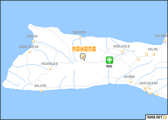
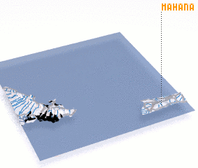
Mahana (Hawaii, United States - USA)Mahana is a town in the Hawaii region of United States - USA. An overview map of the region around Mahana is displayed below.
regional and 3d topo map of Mahana, United States - USA ::
Mahana airports ::
The nearest airport is MKK - Molokai, located 5.4 km east of Mahana.
Other airports nearby include LNY - Lanai (45.6 km south east), JHM - Lahania-kapalua Kapalua (53.7 km south east), NGF - Kaneohe Bay Mcaf (72.2 km north west), OGG - Kahului (79.8 km east), Nearby towns ::
 Places with similar names to Mahana, United States - USA ::
Disclaimer :: Information on this page comes without warranty of any kind |
||
|
Where is Mahana? Elevation and coordinates ::
Latitude (lat): 21°9'14"N Longitude (lon): 157°8'54"W
Elevation (approx.): 181m (map arrows pan, magnifying glasses zoom) |
||
|
Visiting Mahana? Hotel/Accommodation ::
Book a hotel in Mahana Travel Guide ::
rental cars ::
car rental offers GPS waypoint ::
download a GPX waypoint (PoI) of Mahana for your GPS receiver
|
||