|
search place name
|
||
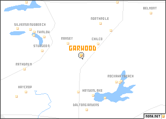
Garwood (Idaho, United States - USA)Garwood is a town in the Idaho region of United States - USA. An overview map of the region around Garwood is displayed below.
regional and 3d topo map of Garwood, United States - USA ::
Garwood airports ::
The nearest airport is SFF - Spokane Felts Fld, located 44.2 km west of Garwood.
Other airports nearby include GEG - Spokane Intl (61.5 km west), SKA - Spokane Fairchild Afb (70.2 km west), YCG - Castlegar (174.7 km north), YXC - Cranbrook (210.9 km north), Nearby towns ::
Chilco (4.2km north east) //
Ramsey (4.3km north west) //
Hayden (7.4km south) //
Hayden Lake (8.3km south) //
North Pole (8.5km north) //
English point (7.1km south east) //
Corbin Junction (7.8km north east) //
Harris Landing (7.6km south east) //
Rockaway Beach (7.5km south east) //
Clarksville (9.3km south) //
Twinlow (7.7km north west) //
[all distances 'as the bird flies' and approximate]  Places with similar names to Garwood, United States - USA ::
Disclaimer :: Information on this page comes without warranty of any kind |
||
|
Where is Garwood? Elevation and coordinates ::
Latitude (lat): 47°49'55"N Longitude (lon): 116°46'35"W
Elevation (approx.): 706m (map arrows pan, magnifying glasses zoom) |
||
|
Visiting Garwood? Hotel/Accommodation ::
Book a hotel in Garwood Travel Guide ::
rental cars ::
car rental offers GPS waypoint ::
download a GPX waypoint (PoI) of Garwood for your GPS receiver
|
||