|
search place name
|
||
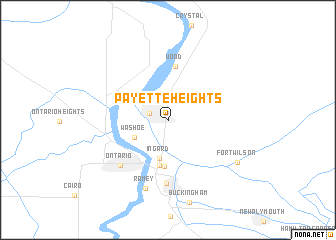
Payette Heights (Idaho, United States - USA)Payette Heights is a town in the Idaho region of United States - USA. An overview map of the region around Payette Heights is displayed below.
regional and 3d topo map of Payette Heights, United States - USA ::
Payette Heights airports ::
The nearest airport is BOI - Boise Air Terminal, located 79.2 km south east of Payette Heights.
Other airports nearby include MUO - Mountain Home Afb (141.9 km south east), Nearby towns ::
Payette (1.7km north west) //
Washoe (3.3km south west) //
Ingard (4.3km south) //
Eiffie (5.2km south) //
Gayway Corner (5.2km south) //
Wood (6.0km north) //
Fruitland (7.1km south) //
Ontario (6.3km south west) //
Ramey (7.9km south) //
Fort Wilson (7.3km south east) //
[all distances 'as the bird flies' and approximate] 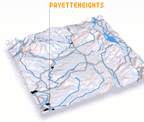 Places with similar names to Payette Heights, United States - USA :: Disclaimer :: Information on this page comes without warranty of any kind |
||
|
Where is Payette Heights? Elevation and coordinates ::
Latitude (lat): 44°4'19"N Longitude (lon): 116°54'50"W
Elevation (approx.): 682m (map arrows pan, magnifying glasses zoom) |
||
|
Visiting Payette Heights? Hotel/Accommodation ::
Book a hotel in Payette Heights Travel Guide ::
rental cars ::
car rental offers GPS waypoint ::
download a GPX waypoint (PoI) of Payette Heights for your GPS receiver
|
||