|
search place name
|
||
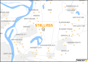
Stallings (Illinois, United States - USA)Stallings is a town in the Illinois region of United States - USA. An overview map of the region around Stallings is displayed below.
regional and 3d topo map of Stallings, United States - USA ::
Stallings airports ::
The nearest airport is STL - St. Louis Lambert St Louis Intl, located 26.8 km west of Stallings.
Other airports nearby include BLV - Belleville Scott Afb Midamerica (28.1 km south east), Nearby towns ::
Four Corners (1.3km south west) //
Pontoon Beach (1.7km north west) //
Moellenbrocks (2.2km south) //
Mitchell (4.6km north west) //
Maryland Place (4.1km west) //
Cedar Park (4.9km north west) //
Brooks (6.0km north west) //
Nameoki (5.7km west) //
Saint Thomas (6.2km north west) //
State Park Place (7.5km south) //
Poag (8.3km north) //
Lakeview (8.4km north) //
Exermont (8.7km south) //
Meadow Heights (7.2km south east) //
Fairmont City (8.7km south) //
Oldenburg (8.7km north) //
Glen Carbon (7.4km east) //
Collinsville (9.1km south east) //
Eagle Park (9.7km south west) //
[all distances 'as the bird flies' and approximate]  Places with similar names to Stallings, United States - USA ::
// Stallion Oaks (US)
// Stallings (US)
// Stehlings (DE)
// Stielings (DE)
// Sete Lenços (PT)
// Stillings (US)
// Stallings (US)
// Stollings (US)
Disclaimer :: Information on this page comes without warranty of any kind |
||
|
Where is Stallings? Elevation and coordinates ::
Latitude (lat): 38°43'29"N Longitude (lon): 90°3'47"W
Elevation (approx.): 128m (map arrows pan, magnifying glasses zoom) |
||
|
Visiting Stallings? Hotel/Accommodation ::
Book a hotel in Stallings Travel Guide ::
rental cars ::
car rental offers GPS waypoint ::
download a GPX waypoint (PoI) of Stallings for your GPS receiver
|
||