|
search place name
|
||
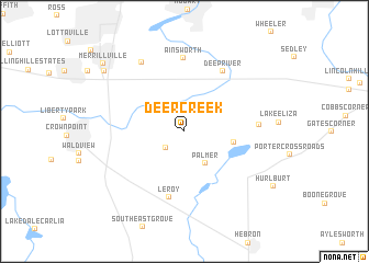
Deer Creek (Indiana, United States - USA)Deer Creek is a town in the Indiana region of United States - USA. An overview map of the region around Deer Creek is displayed below.
regional and 3d topo map of Deer Creek, United States - USA ::
Deer Creek airports ::
The nearest airport is MDW - Chicago Midway Intl, located 57.8 km north west of Deer Creek.
Other airports nearby include IKK - Greater Kankakee (62.7 km south west), ORD - Chicago Ohare Intl (82.1 km north west), GUS - Peru Grissom Arb (126.5 km south east), MKE - Milwaukee General Mitchell Intl (177.6 km north), Nearby towns ::
Winfield (2.2km south west) //
Palmer (3.6km south east) //
Lakes of the Four Seasons (3.9km east) //
Leroy (6.8km south) //
Deep River (6.8km north east) //
Ainsworth (7.5km north) //
Beatrice (5.8km east) //
Green Acres (7.8km north west) //
Chapel Manor (8.7km north west) //
Merrillville (9.3km north west) //
[all distances 'as the bird flies' and approximate]  Places with similar names to Deer Creek, United States - USA ::
// Dry Creek (US)
// Deer Creek (US)
// Deer Creek (US)
// Deer Creek (US)
// Deer Creek (US)
// Deer Creek (US)
// Deer Creek (US)
// Darkorak (IR)
// Darreh Gorg (IR)
// Darreh Gorg (IR)
Disclaimer :: Information on this page comes without warranty of any kind |
||
|
Where is Deer Creek? Elevation and coordinates ::
Latitude (lat): 41°25'14"N Longitude (lon): 87°15'29"W
Elevation (approx.): 216m (map arrows pan, magnifying glasses zoom) |
||
|
Visiting Deer Creek? Hotel/Accommodation ::
Book a hotel in Deer Creek Travel Guide ::
rental cars ::
car rental offers GPS waypoint ::
download a GPX waypoint (PoI) of Deer Creek for your GPS receiver
|
||