|
search place name
|
||
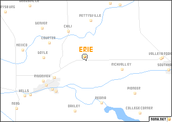
Erie (Indiana, United States - USA)Erie is a town in the Indiana region of United States - USA. An overview map of the region around Erie is displayed below.
regional and 3d topo map of Erie, United States - USA ::
Erie airports ::
The nearest airport is GUS - Peru Grissom Arb, located 21.8 km south west of Erie.
Other airports nearby include IND - Indianapolis Intl (123.1 km south), IKK - Greater Kankakee (159.1 km west), DAY - James M Cox Dayton Intl (180.6 km south east), MDW - Chicago Midway Intl (183.6 km north west), Nearby towns ::
Chili (7.2km north west) //
Oakdale (6.4km south west) //
Richvalley (6.2km east) //
Courter (7.2km north west) //
Park View Heights (8.3km south west) //
South Peru (8.3km south west) //
Peru (8.4km south west) //
[all distances 'as the bird flies' and approximate] 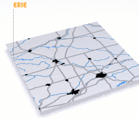 Places with similar names to Erie, United States - USA ::
Disclaimer :: Information on this page comes without warranty of any kind |
||
|
Where is Erie? Elevation and coordinates ::
Latitude (lat): 40°48'4"N Longitude (lon): 85°59'29"W
Elevation (approx.): 244m (map arrows pan, magnifying glasses zoom) |
||
|
Visiting Erie? Hotel/Accommodation ::
Book a hotel in Erie Travel Guide ::
rental cars ::
car rental offers GPS waypoint ::
download a GPX waypoint (PoI) of Erie for your GPS receiver
|
||