|
search place name
|
||
Bondurant (Kentucky, United States - USA)Bondurant is a town in the Kentucky region of United States - USA. An overview map of the region around Bondurant is displayed below.
regional and 3d topo map of Bondurant, United States - USA ::

Bondurant airports ::
The nearest airport is BYH - Blytheville Arkansas Intl, located 83.6 km south west of Bondurant.
Other airports nearby include MKL - Jackson Mc Kellar Sipes Rgnl (108.7 km south), NQA - Millington Rgnl Jetport (138.7 km south), JBR - Jonesboro Muni (141.9 km south west), HOP - Hopkinsville Campbell Aaf (164.0 km east), Nearby towns ::
Ledford (1.7km north east) //
Miller (1.8km west) //
Tyler (3.3km south west) //
Walnut Log (6.2km south) //
Phillippy (6.8km south west) //
Anna Lynne (6.4km north east) //
Grays Camp (8.1km south west) //
[all distances 'as the bird flies' and approximate] 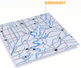 Places with similar names to Bondurant, United States - USA ::
// Bontrand (ZA)
// Bandeirante (BR)
// Bandeirante (BR)
// Bondurant (US)
// Bondurant (US)
// Ban Drun (3) (VN)
// Bandeirante (BR)
Disclaimer :: Information on this page comes without warranty of any kind |
||
|
Where is Bondurant? Elevation and coordinates ::
Latitude (lat): 36°31'24"N Longitude (lon): 89°19'11"W
Elevation (approx.): 88m (map arrows pan, magnifying glasses zoom) |
||
|
Visiting Bondurant? Hotel/Accommodation ::
Book a hotel in Bondurant Travel Guide ::
rental cars ::
car rental offers GPS waypoint ::
download a GPX waypoint (PoI) of Bondurant for your GPS receiver
|
||