|
search place name
|
||
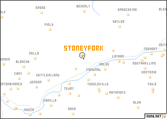
Stoney Fork (Kentucky, United States - USA)Stoney Fork is a town in the Kentucky region of United States - USA. An overview map of the region around Stoney Fork is displayed below.
regional and 3d topo map of Stoney Fork, United States - USA ::
Stoney Fork airports ::
The nearest airport is TYS - Knoxville Mc Ghee Tyson, located 120.6 km south of Stoney Fork.
Other airports nearby include CHA - Chattanooga Lovell Fld (249.9 km south west), Nearby towns ::
Laurel Ford (2.5km south west) //
Cardinal (3.9km south east) //
Blackmont (4.6km south) //
Molus (4.5km south east) //
Callaway (6.0km south west) //
Tacky Town (5.7km east) //
Tuggleville (7.2km south) //
Black Snake (7.7km south) //
Layman (6.4km east) //
Balkan (8.2km south) //
Tejay (8.0km south) //
Kettle Island (7.8km south west) //
Insull (8.7km south east) //
Miracle (9.1km south west) //
Field (9.0km north west) //
Saylor (9.9km north east) //
Pathfork (10.5km south east) //
[all distances 'as the bird flies' and approximate] 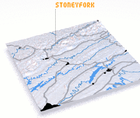 Places with similar names to Stoney Fork, United States - USA ::
Disclaimer :: Information on this page comes without warranty of any kind |
||
|
Where is Stoney Fork? Elevation and coordinates ::
Latitude (lat): 36°49'56"N Longitude (lon): 83°32'5"W
Elevation (approx.): 336m (map arrows pan, magnifying glasses zoom) |
||
|
Visiting Stoney Fork? Hotel/Accommodation ::
Book a hotel in Stoney Fork Travel Guide ::
rental cars ::
car rental offers GPS waypoint ::
download a GPX waypoint (PoI) of Stoney Fork for your GPS receiver
|
||