|
search place name
|
||
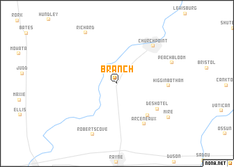
Branch (Louisiana, United States - USA)Branch is a town in the Louisiana region of United States - USA. An overview map of the region around Branch is displayed below.
regional and 3d topo map of Branch, United States - USA ::
Branch airports ::
The nearest airport is LFT - Lafayette Rgnl, located 31.3 km south east of Branch.
Other airports nearby include LCH - Lake Charles Rgnl (95.3 km west), BTR - Baton Rouge Metro Ryan Fld (109.3 km east), AEX - Alexandria Intl (111.8 km north), DRI - Deridder Beauregard Rgnl (116.0 km north west), Nearby towns ::
Castille (6.7km south east) //
Deshotel (6.9km south east) //
Arceneaux (7.5km south east) //
Higginbotham (7.1km east) //
Church Point (7.9km north east) //
Roberts Cove (8.8km south) //
Peach Bloom (8.3km north east) //
Richard (9.2km north west) //
Mire (8.9km south east) //
[all distances 'as the bird flies' and approximate]  Places with similar names to Branch, United States - USA ::
// Bernaich (AT)
// Branch (US)
// Bernočiai (LT)
// Barrenechea (CU)
// Branesh (AL)
// Borynichi (UA)
// Boranchi (RU)
// Buranchi (RU)
// Buruncha (RU)
// Borneh Chāh (IR)
Disclaimer :: Information on this page comes without warranty of any kind |
||
|
Where is Branch? Elevation and coordinates ::
Latitude (lat): 30°20'55"N Longitude (lon): 92°16'3"W
Elevation (approx.): 13m (map arrows pan, magnifying glasses zoom) |
||
|
Visiting Branch? Hotel/Accommodation ::
Book a hotel in Branch Travel Guide ::
rental cars ::
car rental offers GPS waypoint ::
download a GPX waypoint (PoI) of Branch for your GPS receiver
|
||