|
search place name
|
||
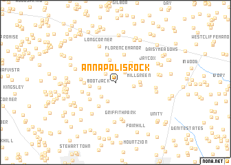
Annapolis Rock (Maryland, United States - USA)Annapolis Rock is a town in the Maryland region of United States - USA. An overview map of the region around Annapolis Rock is displayed below.
regional and 3d topo map of Annapolis Rock, United States - USA ::
Annapolis Rock airports ::
The nearest airport is BWI - Baltimore Washington Intl, located 41.7 km east of Annapolis Rock.
Other airports nearby include IAD - Washington Dulles Intl (46.7 km south west), DCA - Ronald Reagan Washington Natl (48.4 km south), ADW - Camp Springs Andrews Afb (Washington Dc Naf) (57.1 km south east), APG - Aberdeen Phillips Aaf (85.5 km east), Nearby towns ::
Mullinix (1.9km north west) //
Florence Farms (2.1km north east) //
Timberleigh Village (2.3km north) //
Bootjack (2.2km south west) //
Dendor Mar Estates (2.8km north) //
Hipsleys Mill (2.4km east) //
Seneca Overlook (2.9km south west) //
Etchison (3.2km south) //
Florence Estates (3.6km north) //
Mill Green (3.1km east) //
Florence (3.7km north east) //
Cabin River Farms (3.2km east) //
Janwood (3.3km west) //
Shaffers Mill Estates (4.6km north) //
Florence Manor (4.6km north) //
Silver Crest (3.8km south west) //
Seneca Upland (4.4km south west) //
Upper Seneca Crest (4.3km south west) //
Mount Lebanon (4.0km west) //
Hickory Ridge (4.4km west) //
Damascus Valley Estates (4.4km west) //
Griffith Park (6.0km south) //
Jaycox (5.1km north east) //
Long Corner (6.2km north) //
Rocky Road Park (5.9km south west) //
Willett Estates (6.4km south) //
Brook Hollow (6.5km south) //
Daisy Woods (5.1km east) //
Jennings Chapel Woods (5.3km east) //
[all distances 'as the bird flies' and approximate]  Places with similar names to Annapolis Rock, United States - USA :: Disclaimer :: Information on this page comes without warranty of any kind |
||
|
Where is Annapolis Rock? Elevation and coordinates ::
Latitude (lat): 39°16'54"N Longitude (lon): 77°7'55"W
Elevation (approx.): 168m (map arrows pan, magnifying glasses zoom) |
||
|
Visiting Annapolis Rock? Hotel/Accommodation ::
Book a hotel in Annapolis Rock Travel Guide ::
rental cars ::
car rental offers GPS waypoint ::
download a GPX waypoint (PoI) of Annapolis Rock for your GPS receiver
|
||