|
search place name
|
||
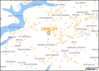
Camelot (Maryland, United States - USA)Camelot is a town in the Maryland region of United States - USA. An overview map of the region around Camelot is displayed below.
regional and 3d topo map of Camelot, United States - USA ::
Camelot airports ::
The nearest airport is ADW - Camp Springs Andrews Afb (Washington Dc Naf), located 28.3 km north east of Camelot.
Other airports nearby include DCA - Ronald Reagan Washington Natl (29.2 km north), IAD - Washington Dulles Intl (54.3 km north west), NHK - Patuxent River Nas (63.4 km south east), BWI - Baltimore Washington Intl (72.2 km north east), Nearby towns ::
Pomfret (1.3km south) //
Pomfret Estates (1.6km south) //
Countryside (1.7km north) //
Billingsley Forest (1.8km north) //
Robie Manor (1.6km north east) //
Avon Crest (1.5km east) //
King George Estates (1.5km east) //
Quiet Acres (2.0km north) //
Foxhall Estates (2.2km north) //
Columbia Park (1.9km east) //
Oakwood (2.5km south) //
Tarrington Creek (2.5km north east) //
Bennsville (2.6km north east) //
Freedom Village (2.9km north) //
Pheasant Farm (2.8km south east) //
Shady Acres (3.4km north) //
Mount Carmel Estates (3.5km south east) //
Green Acres Estates (3.1km east) //
Oak Knolls (3.4km east) //
Oak Hill Estates (3.4km east) //
Hillwood (3.5km east) //
Eutaw Forest (4.3km north) //
Spring Valley (3.5km north east) //
Twinbrook Estates (4.2km north east) //
Mount Carmel (4.2km south east) //
Mount Carmel Woods (3.9km south east) //
Marshalls Corner (4.5km south) //
Turkey Hill (3.8km south east) //
Billingsley Park (3.7km east) //
[all distances 'as the bird flies' and approximate] 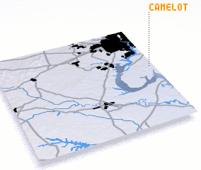 Places with similar names to Camelot, United States - USA ::
Disclaimer :: Information on this page comes without warranty of any kind |
||
|
Where is Camelot? Elevation and coordinates ::
Latitude (lat): 38°35'20"N Longitude (lon): 77°1'39"W
Elevation (approx.): 54m (map arrows pan, magnifying glasses zoom) |
||
|
Visiting Camelot? Hotel/Accommodation ::
Book a hotel in Camelot Travel Guide ::
rental cars ::
car rental offers GPS waypoint ::
download a GPX waypoint (PoI) of Camelot for your GPS receiver
|
||